Background to the scheme
Click on a heading to read more
Newbury’s industrial history
Historically the site has been home to small and large-scale industries extending over at least 600 years and including cloth and marine iron works.
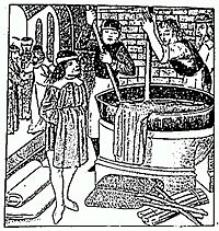
The site currently occupied by the Kennet Shopping Centre (since 1974) has always been an important part of the history of Newbury. As early as the 15th century this site was renowned across Europe for the production and manufacture of high quality twill-backed cloths. From 1465 to 1533, the Winchcombe family were known as clothiers par excellence, with their clothing being highly sought after all across Europe. Of particular note was the manufacture of ‘Kerseys’, 1 yard by 16 yard pieces of fabric dyed in rich tones using woad, a yellow flowered plant grown in Britain that produced high quality dye.
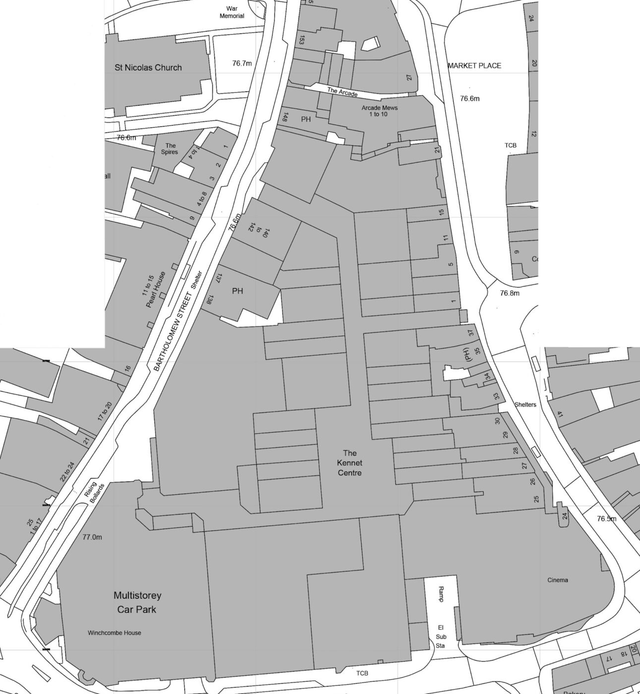
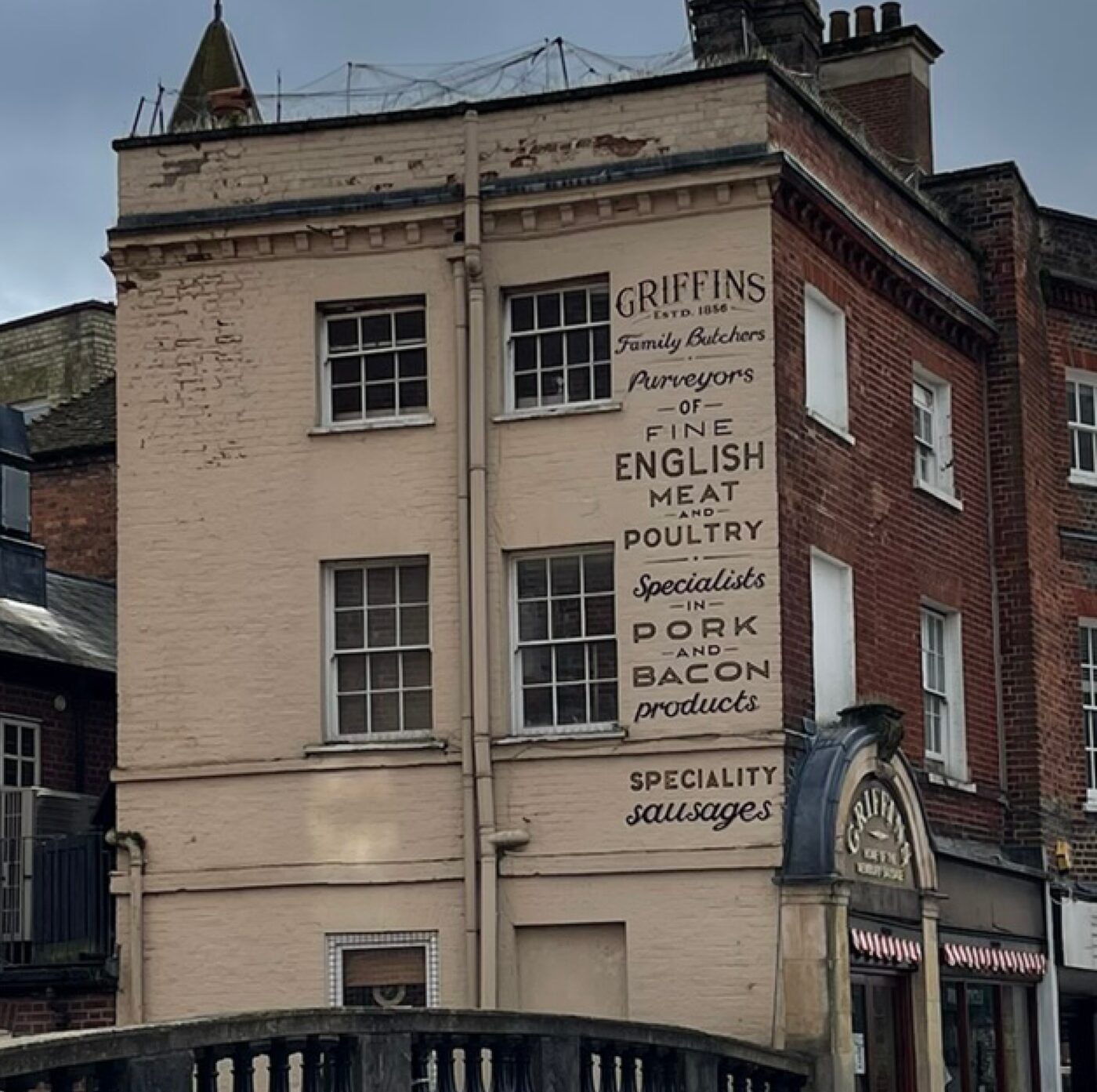
Towards the end of the 18th century, the centre of Newbury enjoyed a more industrial heritage. This site became Plenty’s Eagle Iron Works, an engineering works founded by William Plenty who went on to design and build steam engines and boilers for ships across the world, including the Royal Navy, and lifeboats for the Royal National Lifeboat Institution. One can see from the map of 1880 the large works in the centre of the site and the smaller narrower plots that formed the remainder of the site.
The next major change to the site occurred between 1960 and 1982 when the Kennet Shopping Centre was conceived, designed and developed, effectively clearing away much of the historical grain and character from this site.


The Kennet Centre’s history
The area between Bartholomew Street, Cheap Street and Market Place was one of the earliest occupied areas of the medieval town of Newbury.
1960 – 1985 BUILDING THE KENNET CENTRE
In the 1960s, an initial scheme to construct a new shopping centre on the area between Bartholomew Street, Cheap Street and Market Place in Newbury town centre was proposed, to be completed in several phases. By 1974 the first stage of the work to create a supermarket, bank and around 20 other shops was complete. In 1982, work on phase II of the scheme began. This aimed to double the size of the existing shopping centre (renamed the Kennet Centre) and to create covered walking areas. In 1984, plans were approved by the local authority for a new bus station, Sainsbury’s supermarket, a new department store and a new car park, to create a total of 55 shops on a 5 acre site. The new shops were completed in the summer of 1985. A number of older buildings along the street frontages were retained, mainly towards the northern end.
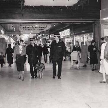
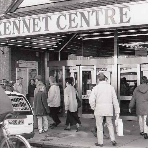
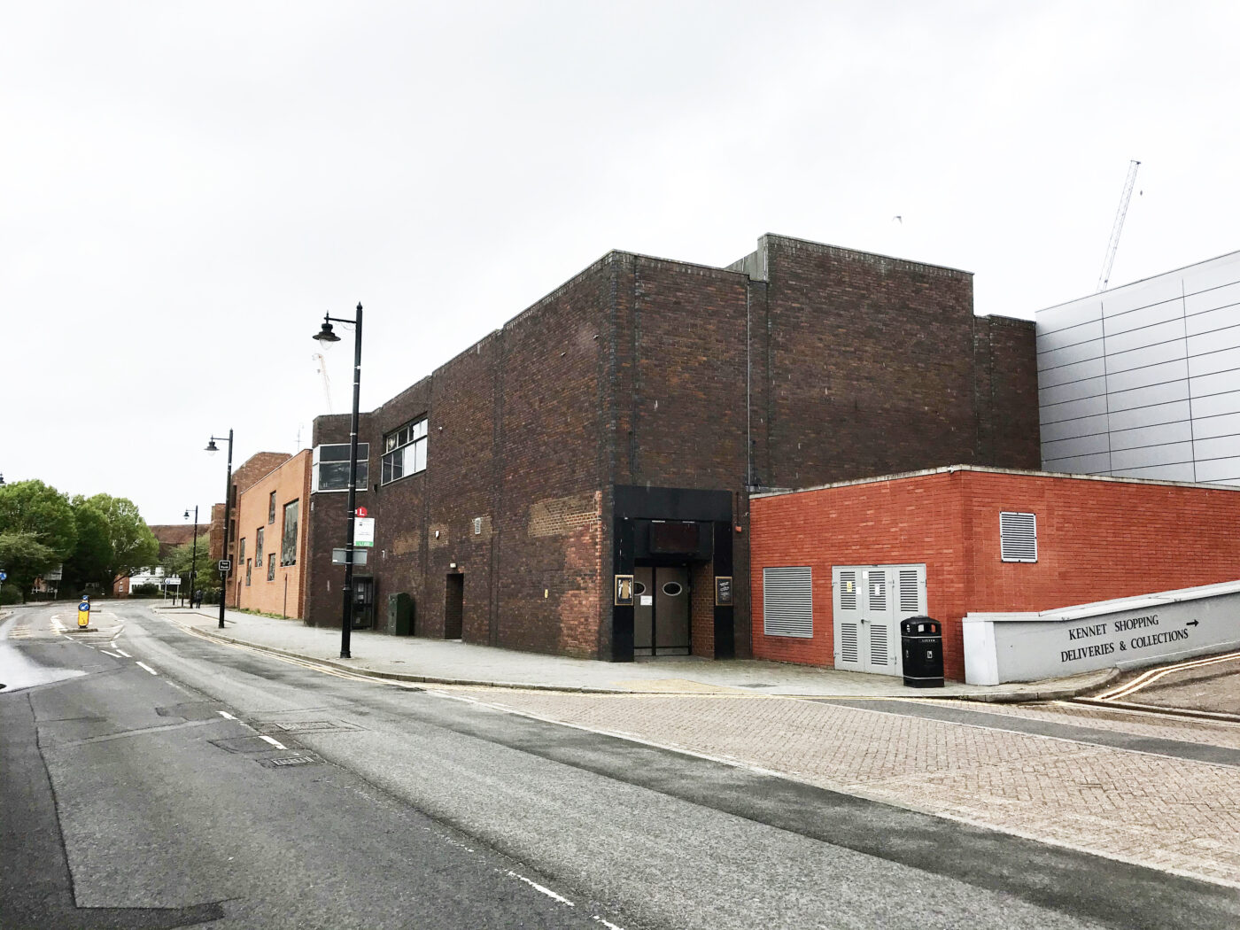
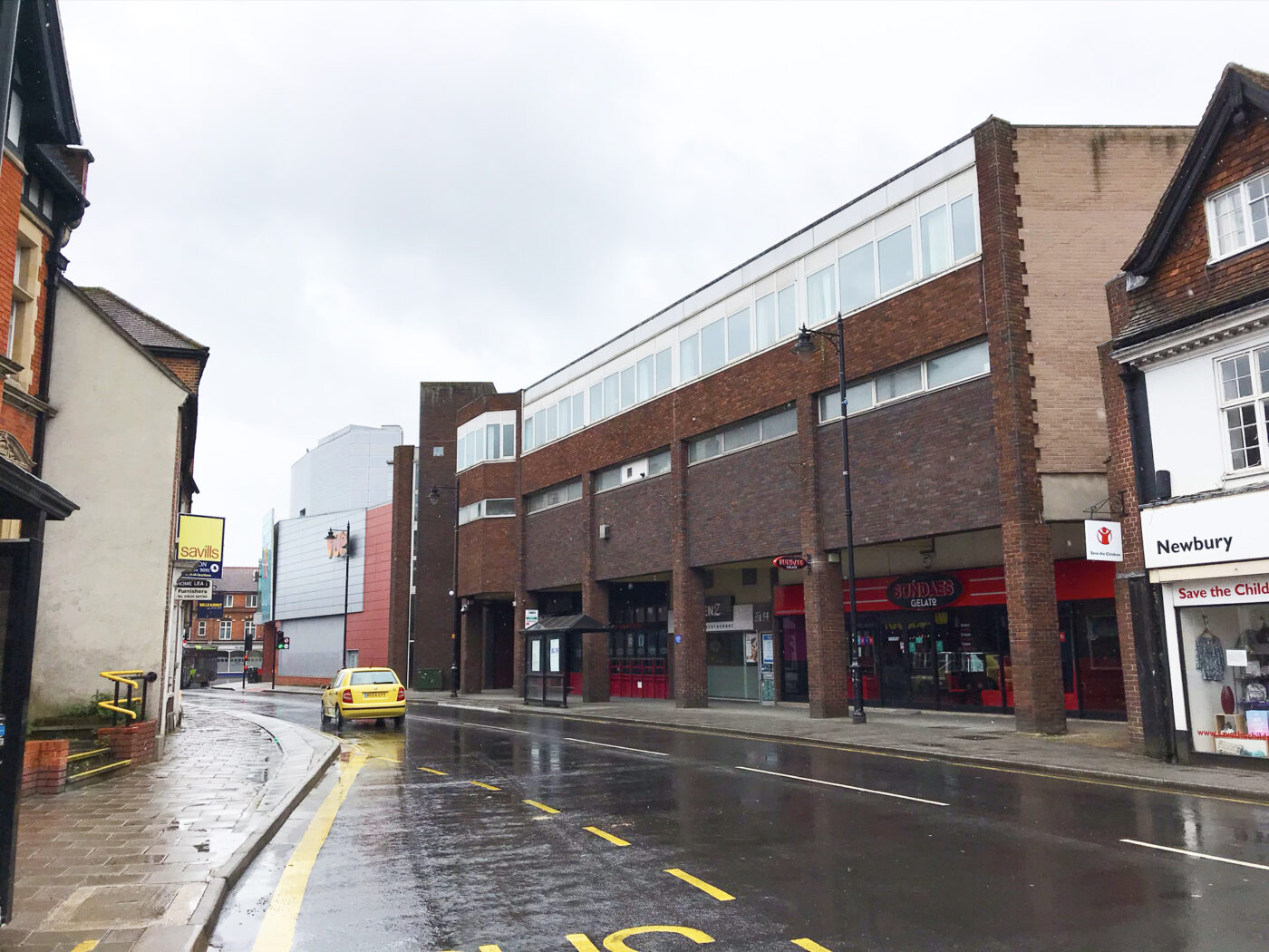
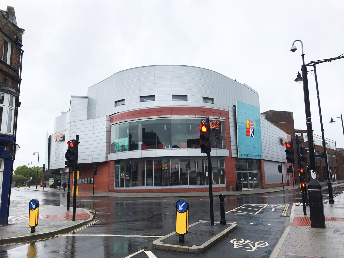
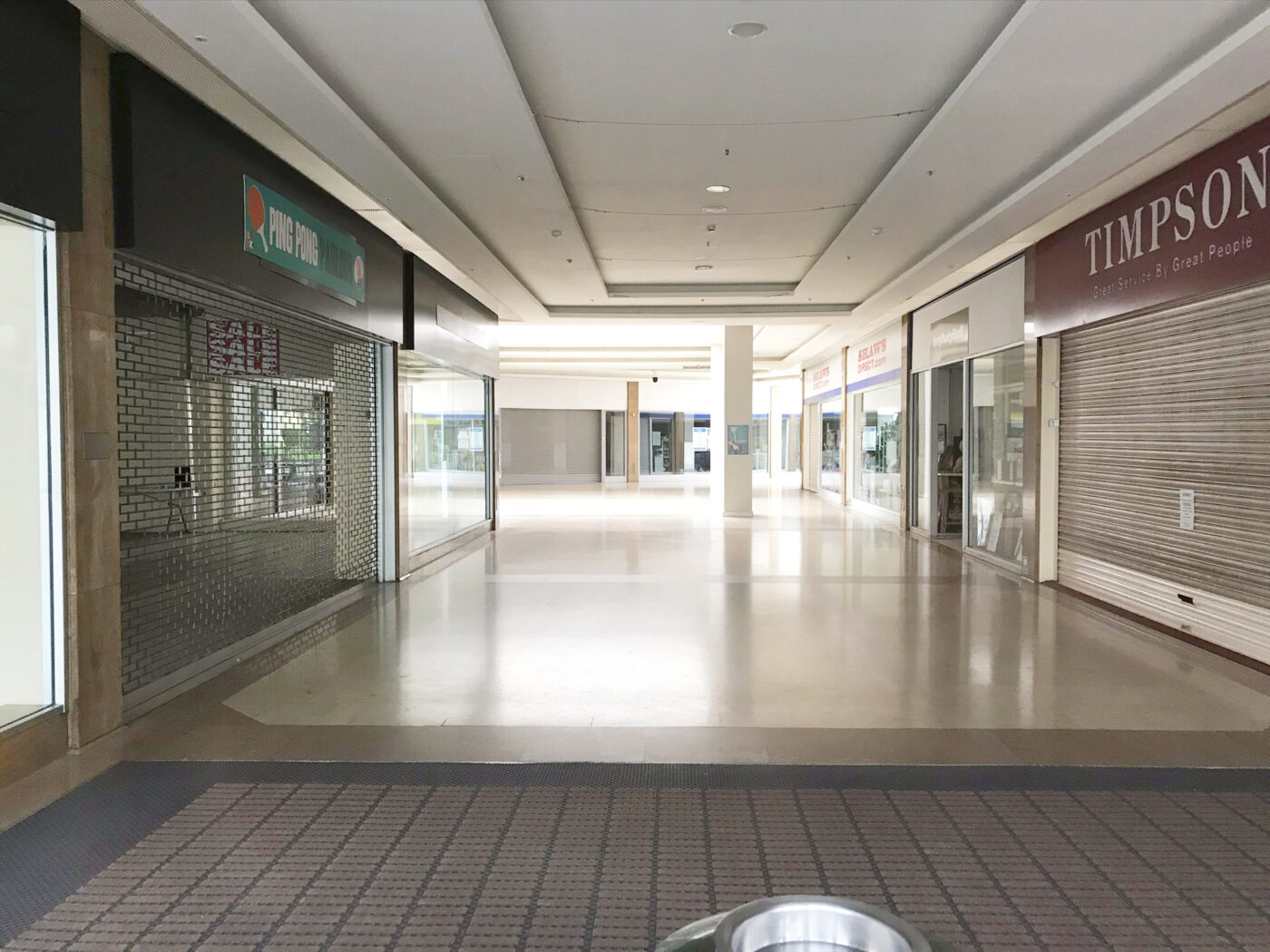
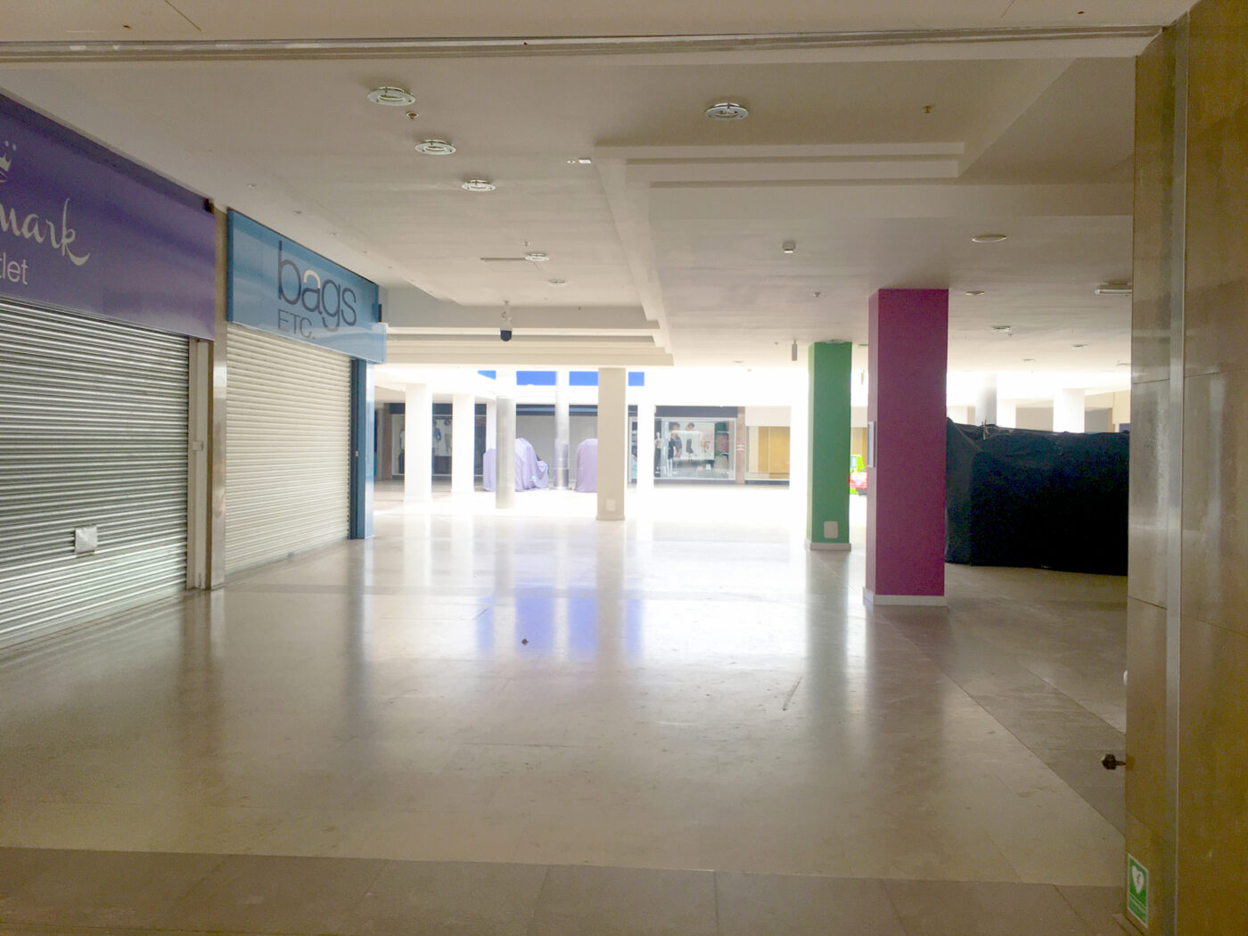
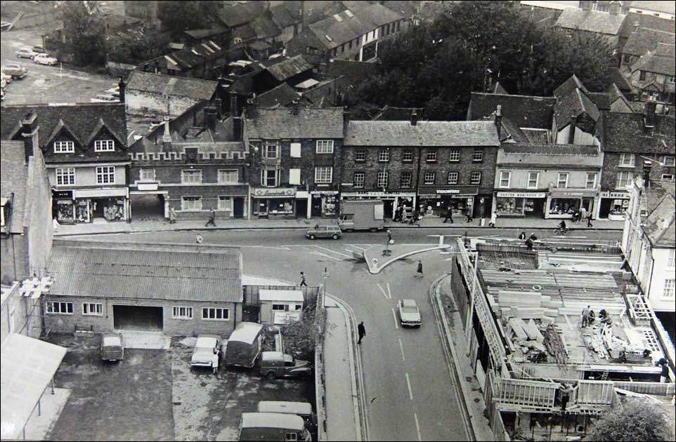
THE KENNET CENTRE TODAY
With the changing landscape of the retail sector and with the physical limitations and dated appearance of the Kennet Centre, it has been suffering a decline in recent years. Whilst we have managed to attract some interim interest, the long term prospects for regenerating this centre in its current form are limited as there is little or no interest in this type of retail space.
Heritage Context
Existing character of Newbury
The majority of Newbury town centre is within the Conservation Area and contains a concentration of designated and non-designated heritage assets. The buildings within the town centre vary in age, quality, and architectural styles, creating a varied and interesting townscape. These buildings span multiple periods from the medieval era to the modern age.
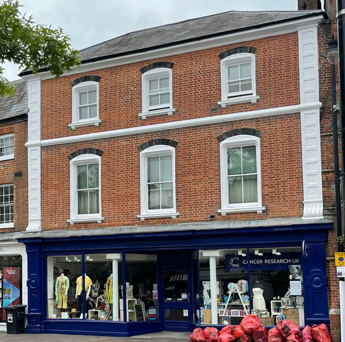
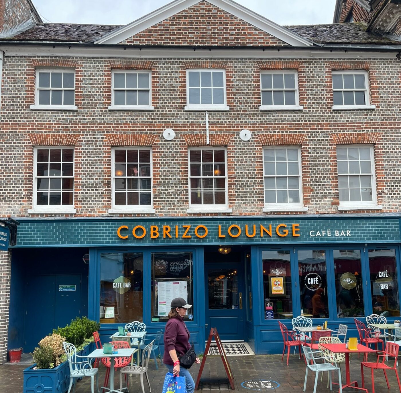
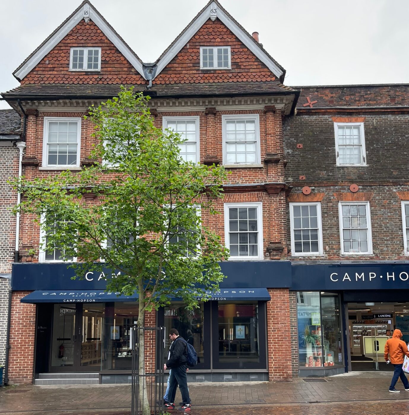
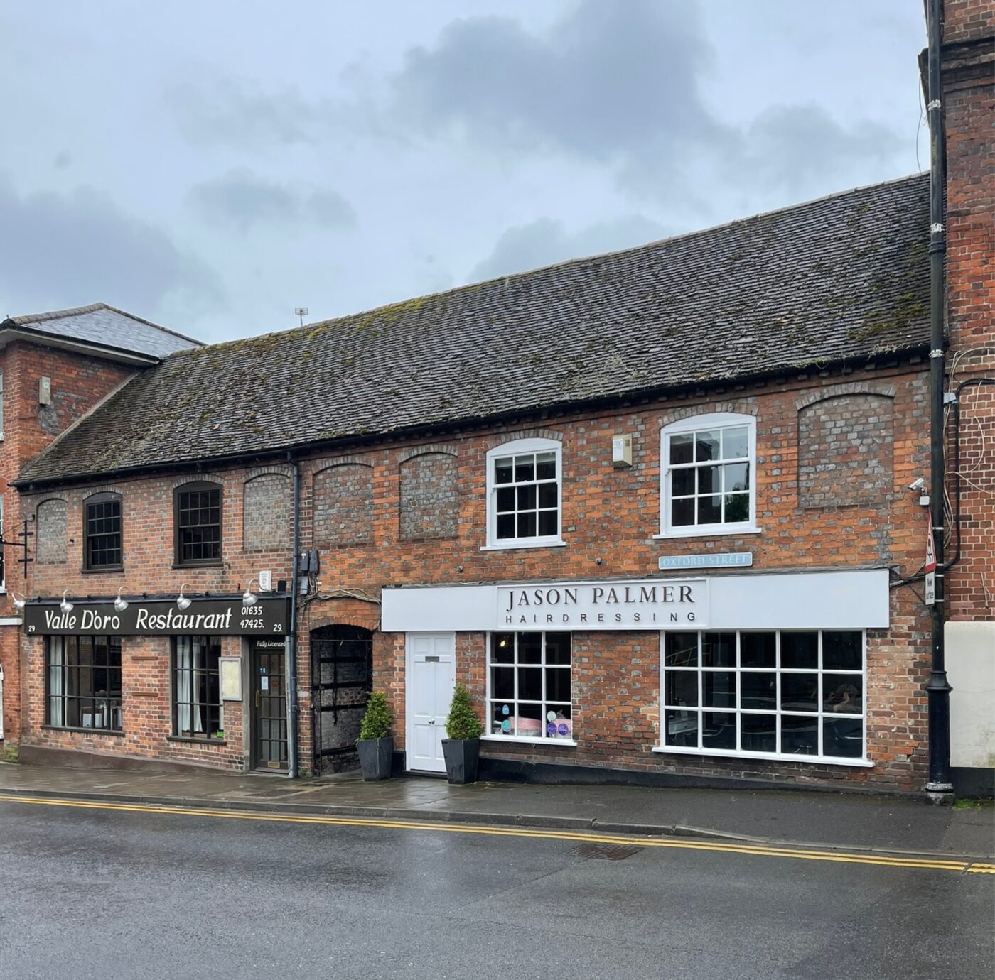
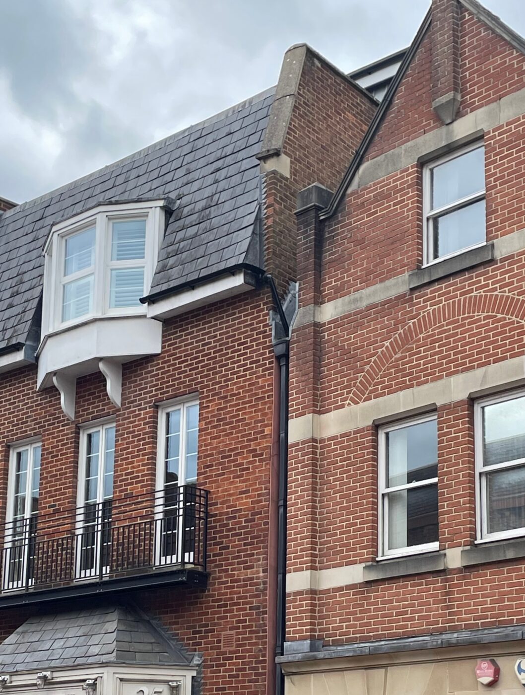
The dense historic medieval core of Newbury is centred around Northbrook Street to the North of the town centre, and Bartholomew Street and Cheap Street to the West and East, converging at the bridge over the River Kennet. The street pattern of Newbury retains its fundamental medieval route structure, reflecting its historical role as a centre of mercantile trade. Wide streets and open spaces, historically used for markets, continue to serve as primary shopping routes, with a tighter urban grain surrounding, including numerous passages and alleys, such as The Arcade, The Eight Bells, and Weavers Walk, which link these spaces and contribute to the town’s character. The older buildings generally rise between two and four storeys, with taller landmarks such as the clock-tower of the Victorian town hall.
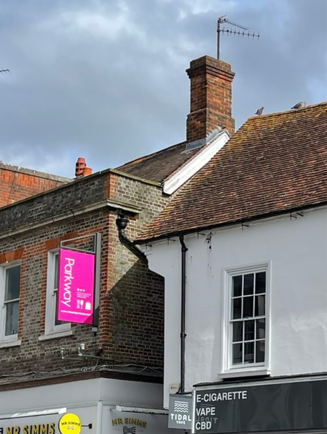
Modern and contemporary developments, such as the mixed-use Parkway development and Weavers Yard, take cues from the range of architectural styles found in the town centre but are generally contemporary in character, consist of large blocks and are taller than the prevailing town centre, between 3 and 9 storeys in height.
Site Prior to the Kennet Centre
The triangular area between Bartholomew Street, Cheap Street and Market Street that comprises the Kennet Shopping Centre was one of the earliest occupied areas of the medieval town. Evidence from archaeological excavations by Oxford Archaeology have shown it was laid out with burgage plots (enclosed fields used for agriculture or small-scale farming) along both sides until the 18th century.
Between the late eighteenth and nineteenth centuries, the built form was predominantly composed of small-grained blocks, characterised by central buildings which were surrounded by smaller ancillary structures or outbuildings. Hardstanding areas were evident between buildings forming yard areas and spaces for storage.
The Northern areas of the site were notably denser. In terms of scale, the buildings varied between one and three storeys. Brick is evident as the prominent material used in buildings and structure, with a mix of gabled and hipped roofs above, echoing the wider traditional architectural forms within the town centre. Tall brick chimneys were a prominent feature in the roofscape, not only serving functional purposes but also contributing to the visual identity of the area.
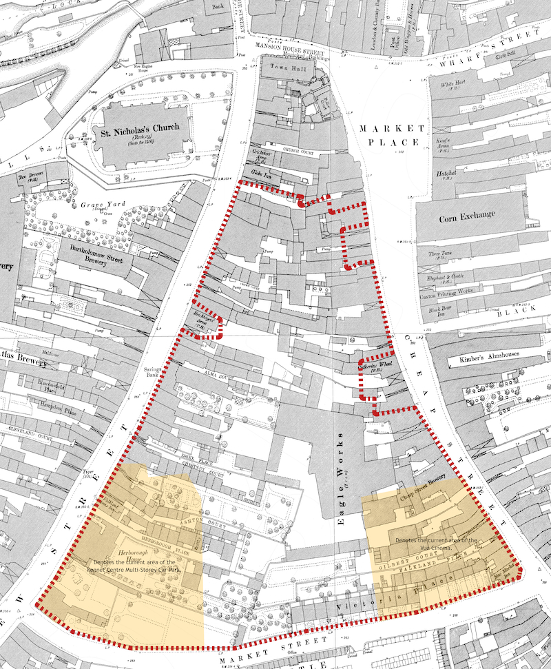
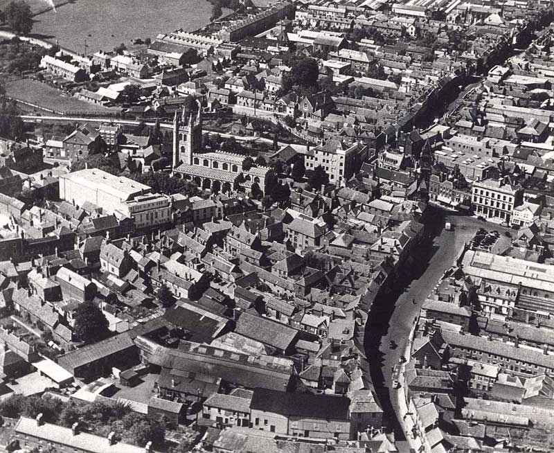
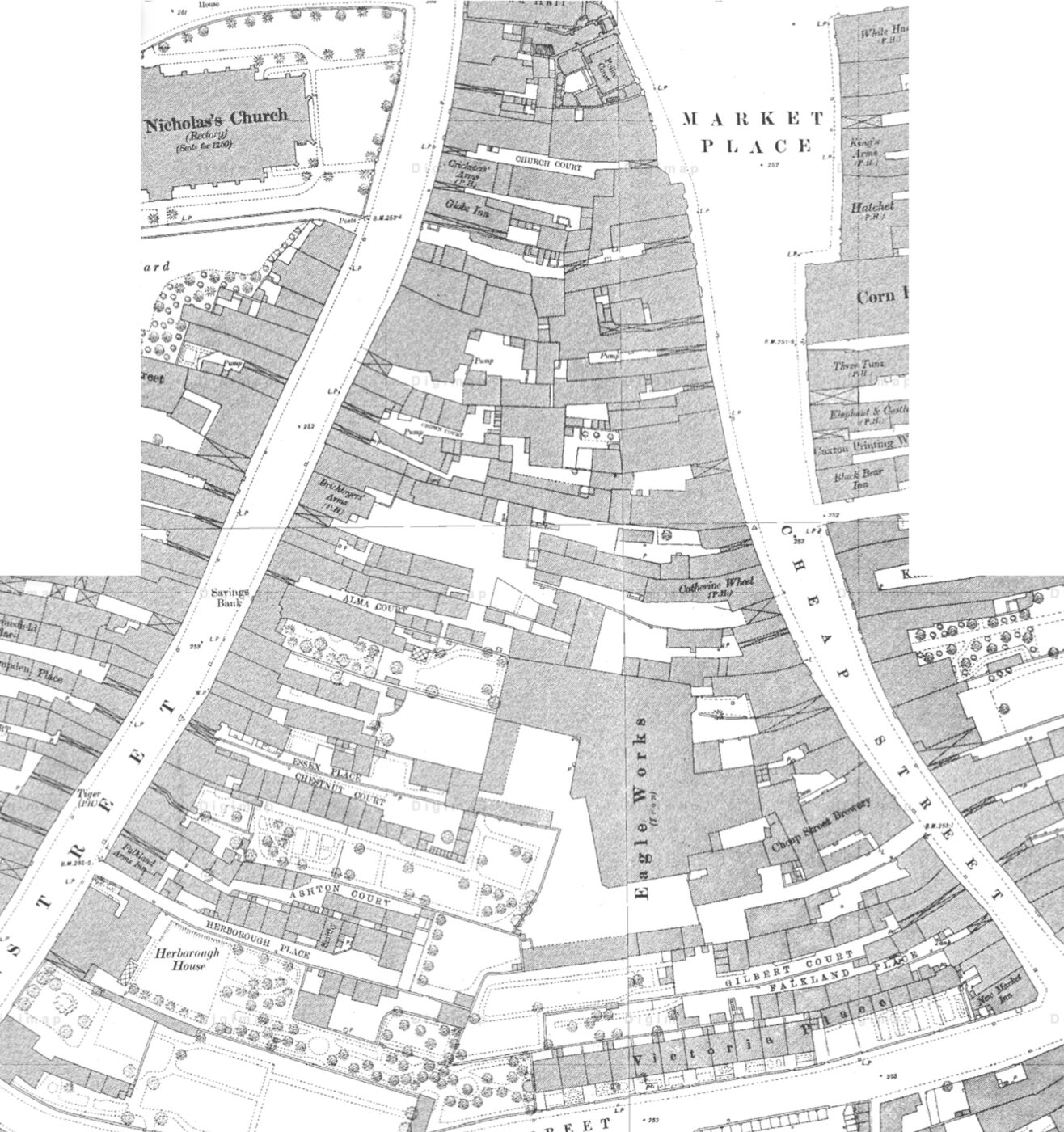
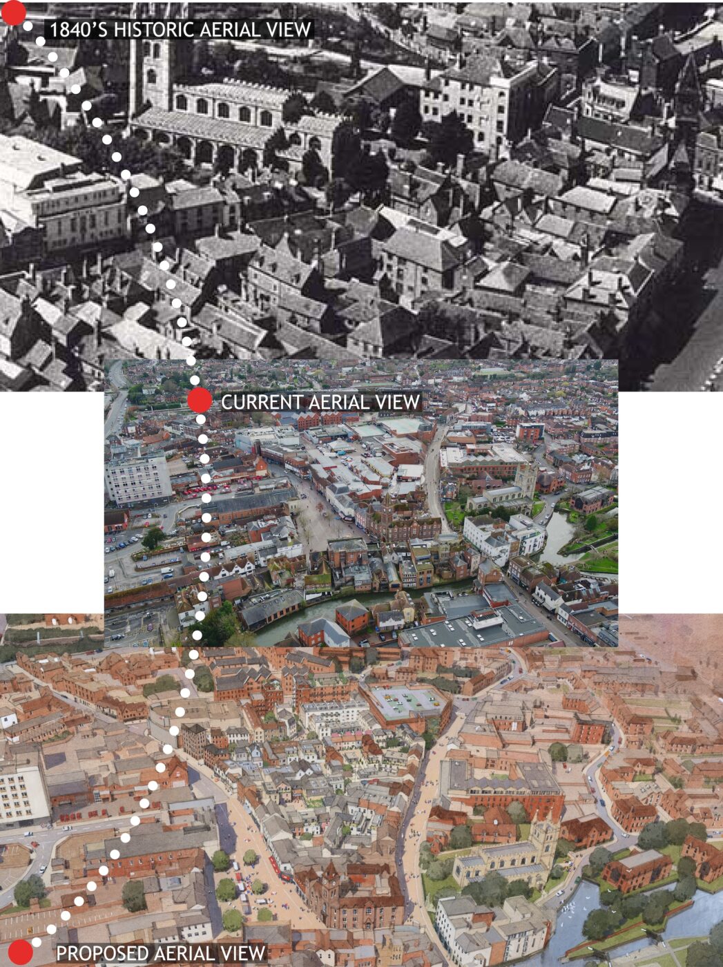
1880’S Historic Map – The application site is indicatively outlined in red
This historic map (click image to enlarge) shows the application site and surrounding context as it once was before the demolition and the construction of the Kennet Centre, the Cinema and the Kennet Centre Multi-storey Car Park.
We can see from this map the east-west axis of the linear burgage plots that present a tight-knit environment of Yards, Courts and Places behind a large building that addresses the main movement routes. We can observe from this map the gradual loss of ‘white space’ within the site. This is as a consequence of backfill development being undertaken within the burgage plots, gradually increasing the density and mass over time.
The Yards, Courts and Places contained modest living accommodation, and cottage industries, along with the larger industrial units, such as Eagle (Iron) Works.
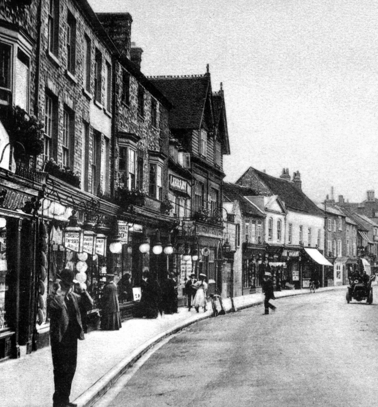
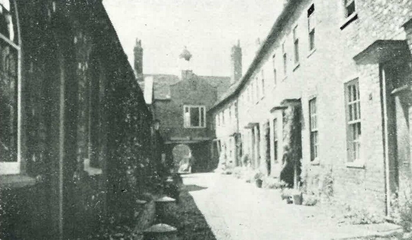
Early 1900’S Bartholomew Street
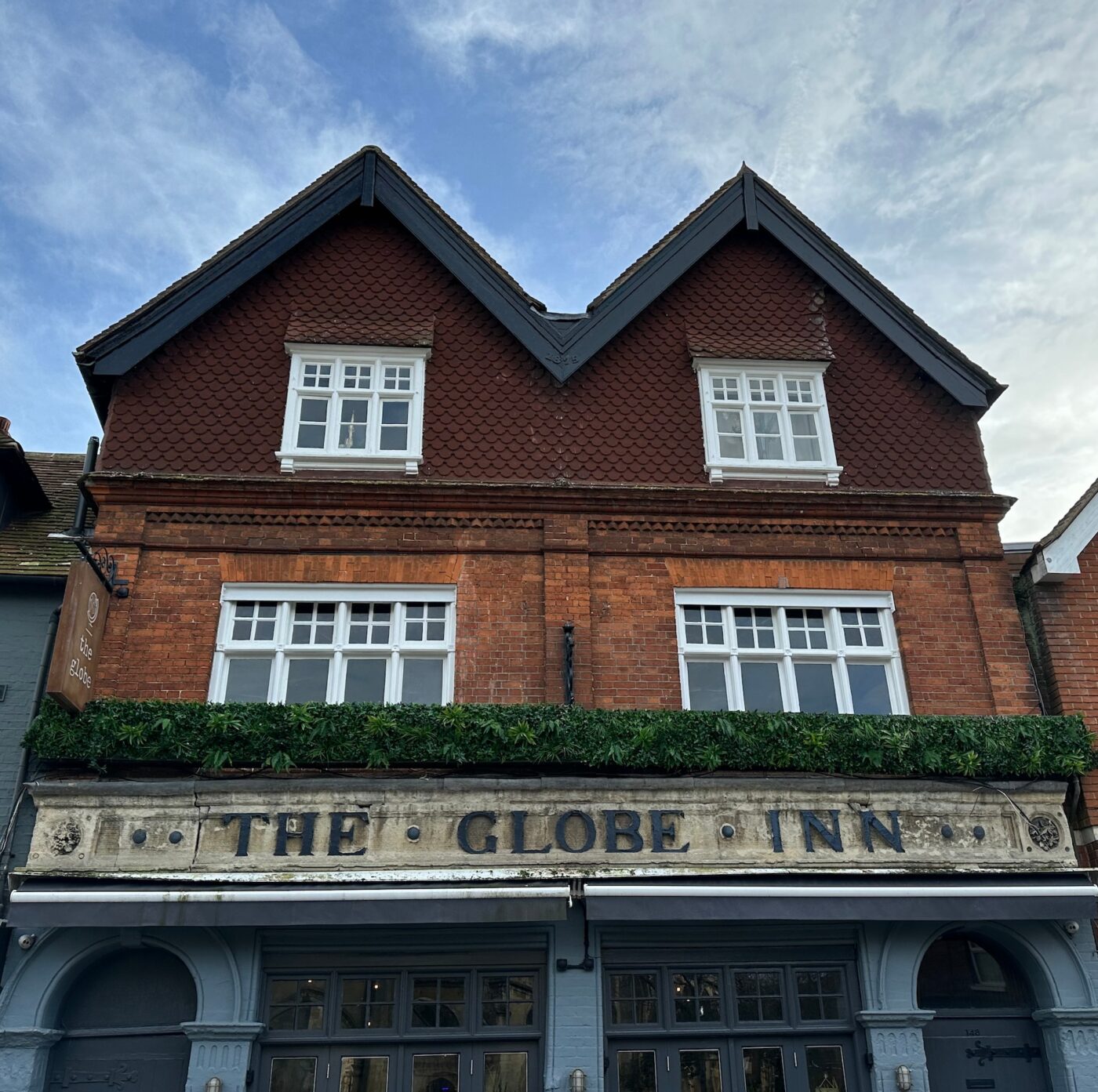
We can see from this photograph (click image to enlarge) the sweeping building frontage following the street. The Globe Inn (the double-gabled fronted building) is a landmark in the photo that still exists. However, when we compare this photo with the street scene today, the mix of building forms, scales and materials that underpin the character of the Conservation Area has been lost, mainly due to the construction of the Kennet Centre.
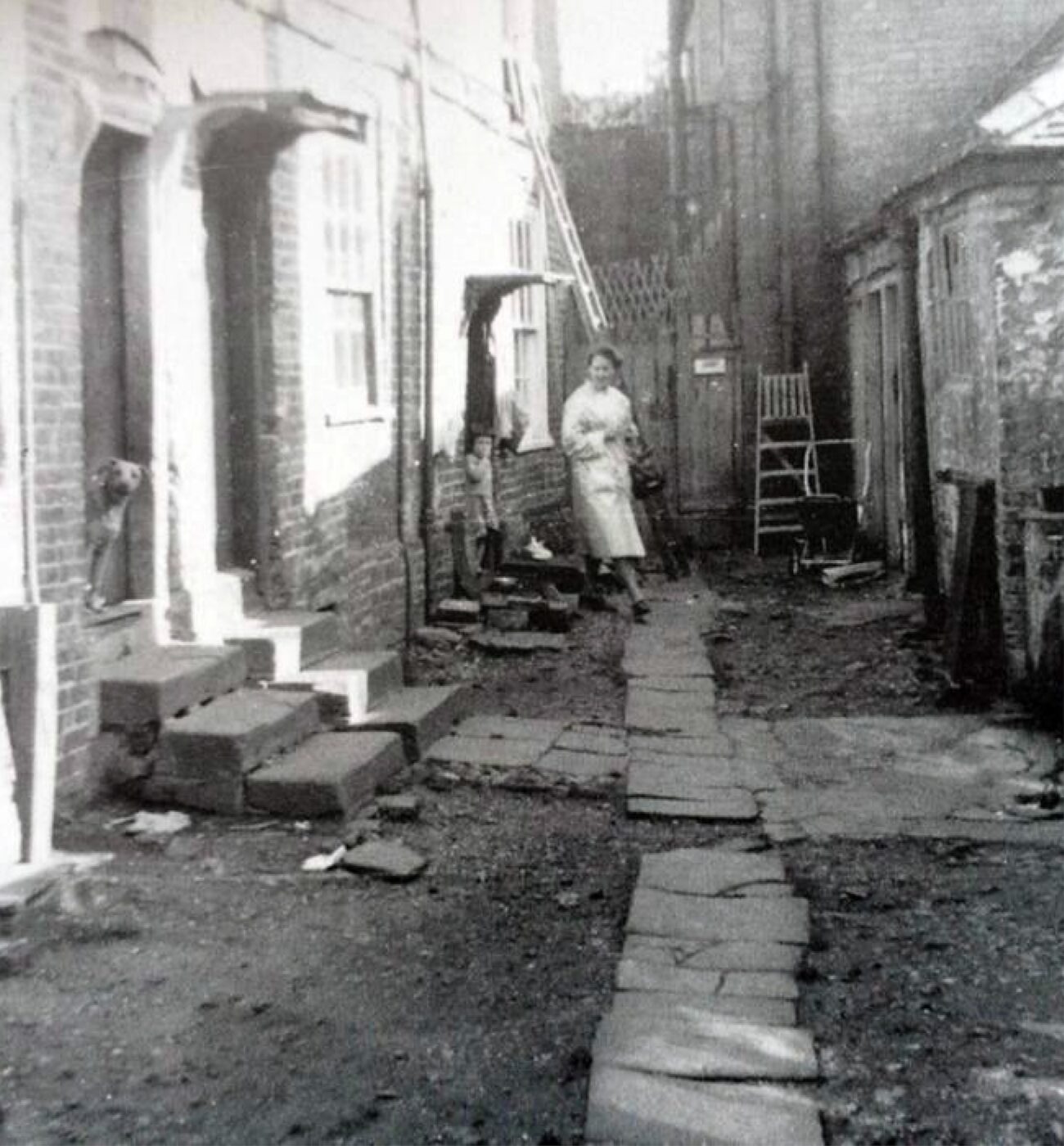
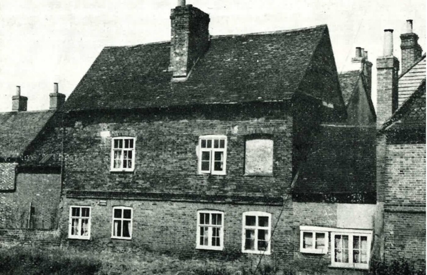
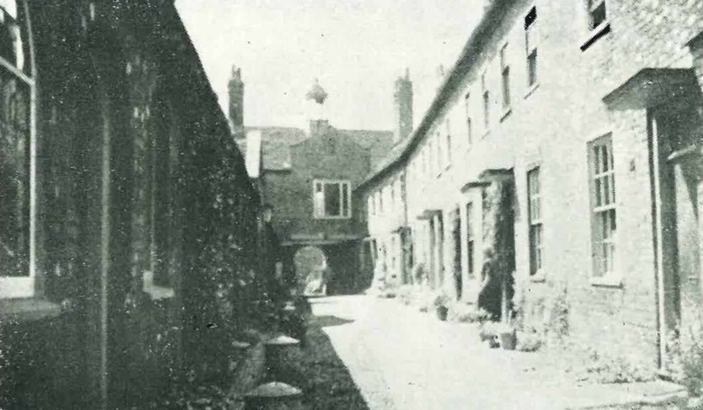
1940’s Living Quarters – Crown Court
A rare glimpse of life within the burgage plots, this photograph (click image to enlarge) illustrates the tight-knit built environment within Crown Court – previously off Bartholomew Street between The Bricklayers Arms (now The Newbury) and The Globe Inn.
We can observe the modest Georgian houses with their sliding sash windows, brick arches, string courses, modest porches and stepped thresholds opposite a wash/pump house. Crown Court can be seen on the 1880’s Map, which confirms the close built environment these dwellings often existed within, as is the case here, with little or no amenity space, save for the frontage passageway.

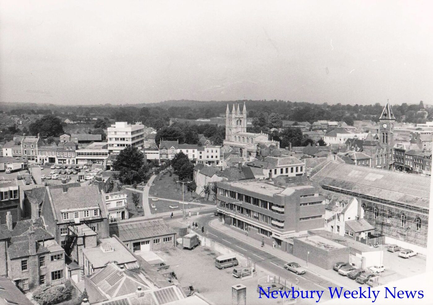
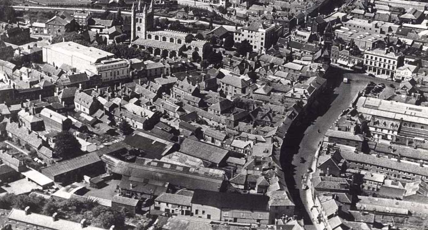
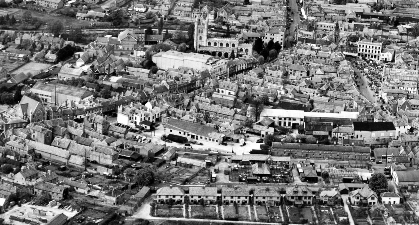
C.1940’S aerial photo
Illustrates the tight-knit character, varying building scale, typology and juxtaposition of roof forms. The c.1940’s and 1950’s photographs show the densely knitted development of the site prior to the development of the Kennet Centre. These photographs are comparable to the built-form layout illustrated in the c.1880’s Map.
The photographs (click image to enlarge) clearly illustrate the following Newbury Town Conservation Area characteristics; tight-knit built-form environment; an East-West axis of deep plots served by Carriage Arches, Ginnels and Passageways; a transition of high mass to lower mass from North to South; a wonderful juxtaposition of roof forms, differing building typologies, differing scales and orientations; use of Courts and Yards as amenity space with limited or no vehicular access, i.e. virtually all the dwellings had predominantly pedestrian access.
C.1950’S aerial photo
Little had changed over 10 years, save for building forms and materials around the Eagle Works area (click image to enlarge).
Present figure-ground plan
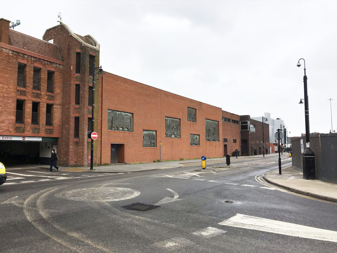
The shopping centre layout (click image to enlarge) removes all historic characteristics from the site, alien to the character of the wider Conservation Area. Not only this, the Kennet Centre presents a monolithic mass of built form that is impenetrable, aside from the access through the site during daytime hours.
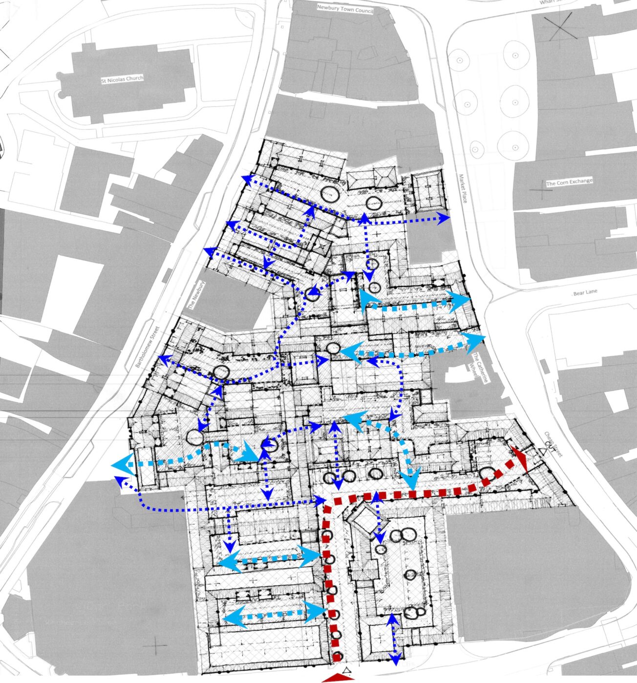
Early concept layout – with permeability illustrated
The design team explored numerous layout solutions that sought to reintroduce the historic urban grain character that reflected the 1880’s Map but also delivered a development that catered for modern expectations. The Concept Layout, as illustrated with the blue arrows (click image to enlarge), shows how linkages through Carriage Arches, Ginnels and Passageways into Yards, Courts and Places can be created when the site connects to the surrounding streets.
1880’s figure-ground plan
The 1880’s plan (click image to enlarge) has provided the inspiration for the proposed layout. A key feature is the permeability that used to exist via the numerous carriage arches, ginnels, passageways and also how the density reduces as you head from north to south.

Proposed figure-ground plan
The proposed layout plan (click image to enlarge) looks to the 1880’s plan for inspiration, and reflects the close-knit character, especially in the northern part of the site. The layout also allows for the development to cater for modern living, incorporating amenity space, car and cycle parking, and refuse storage.
Vision Statement
Having undertaken an extensive architectural and character study of the Newbury Conservation Area, the Design Team, along with the Applicant, have sought to re-imagine tight-knit urban housing on the site.
This led to the following Vision Statement.
- Enhance the Conservation Area by creating a new development that restores the character of this part of Newbury, knitting it back into the urban grain of the historic settlement pattern.
- To deliver that objective within the remit of modern expectations for sustainable living accommodation, sense of place, ownership and belonging within a development rich in charm, character, and amenity.
- Therefore, this development will be special. It will enhance the Conservation Area, restoring the identity of this part of Newbury while also meeting modern living expectations.
The surrounding images are photographs from the early 19th Century to the modern day, illustrating the distinctive charm and character of Newbury town centre.
The Design Team have sought to reflect the historic character of Newbury within the proposal.
Click images to enlarge and see details.
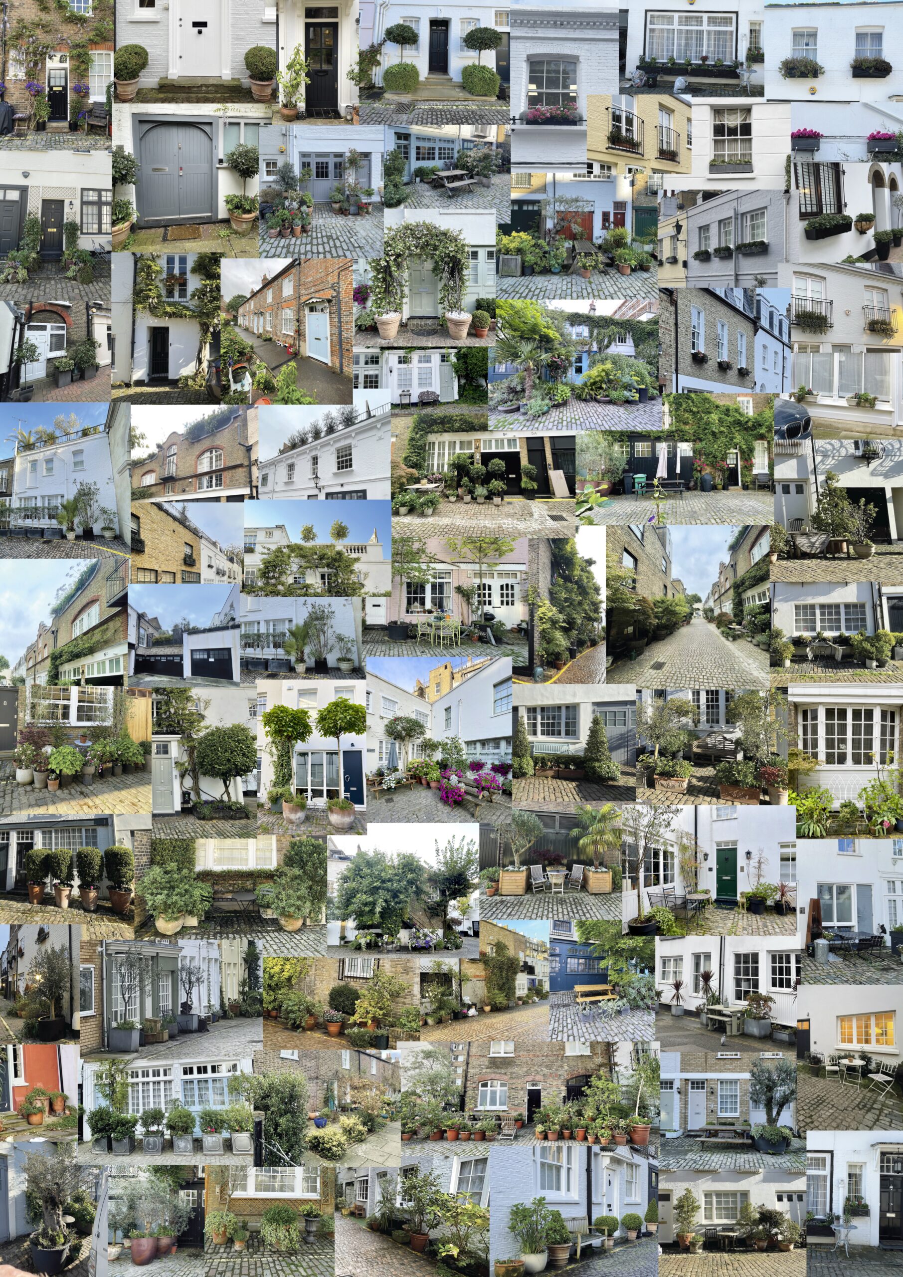
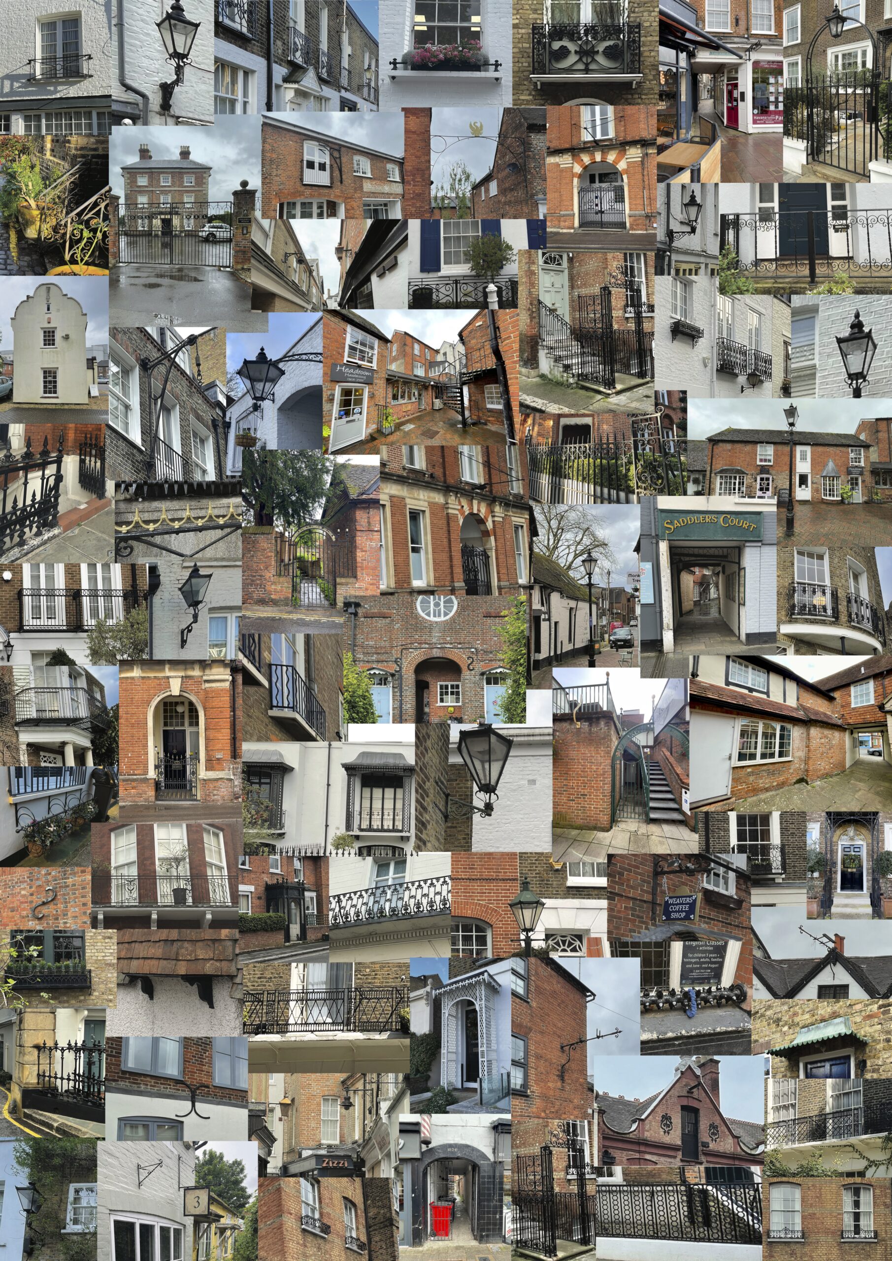
Place Study
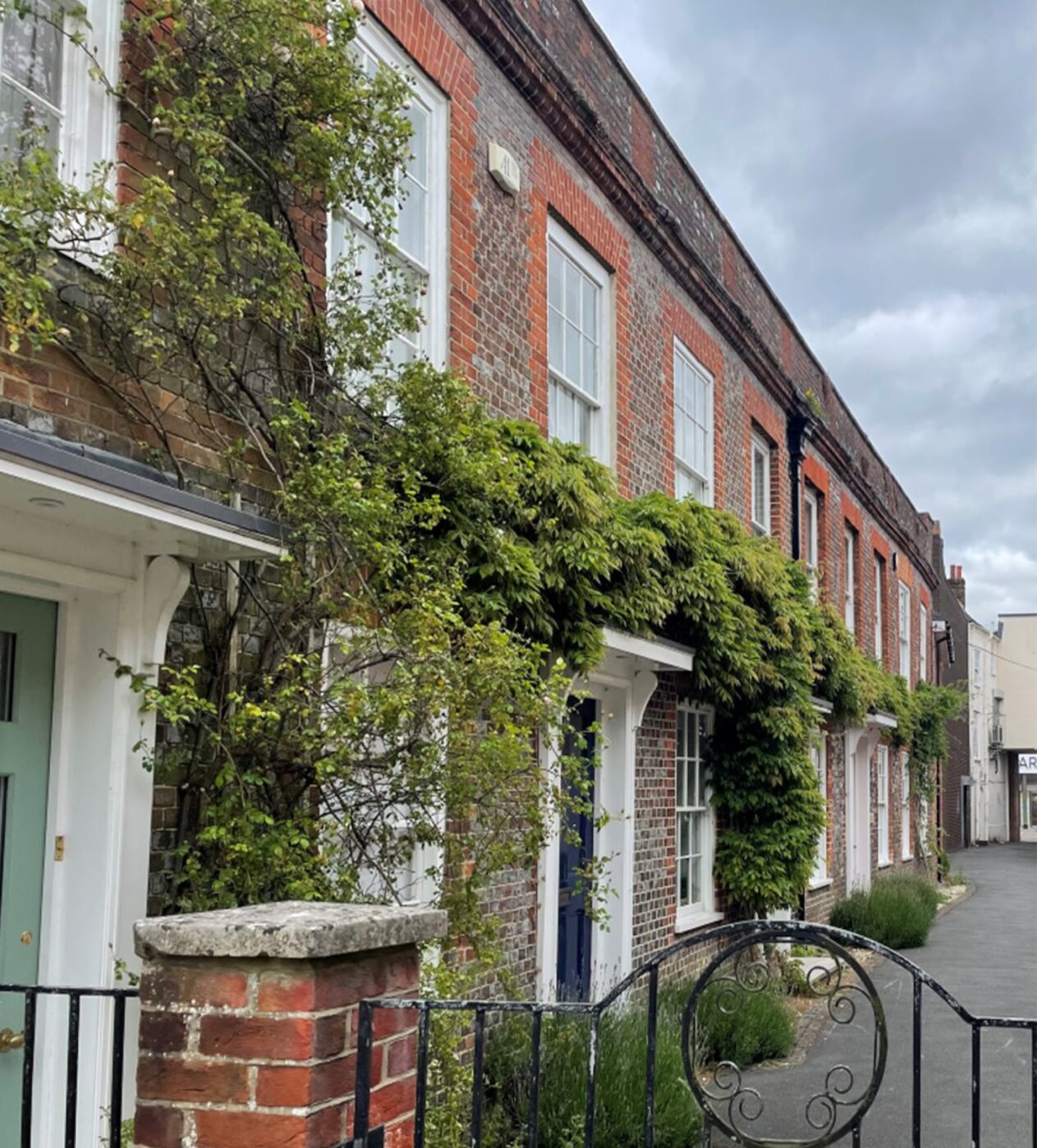
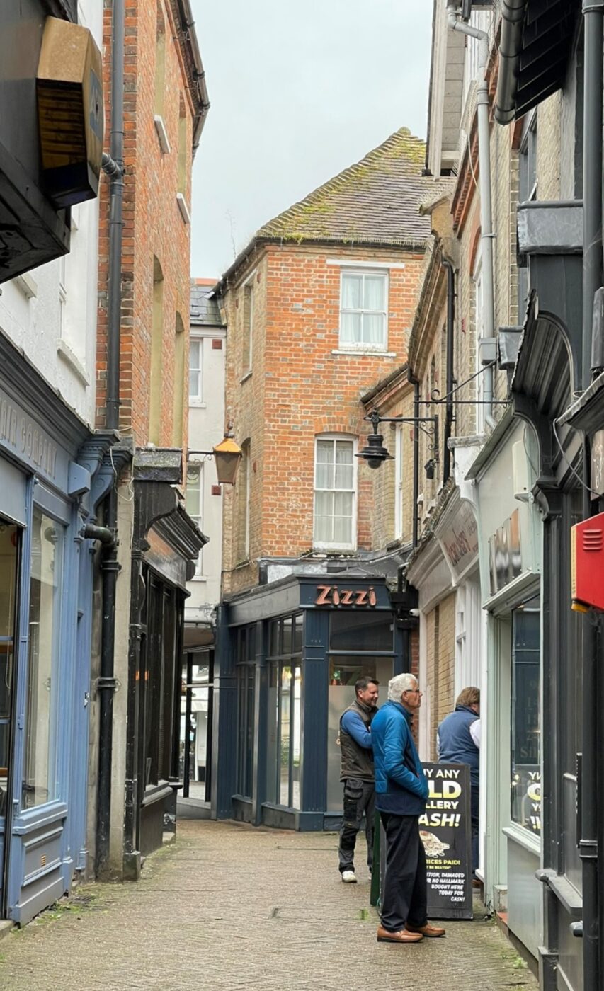
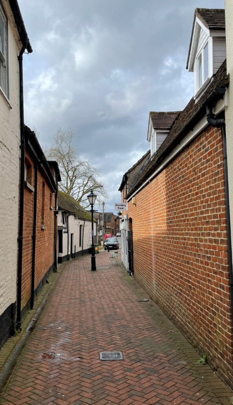
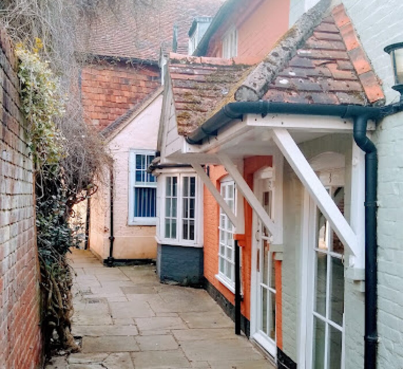
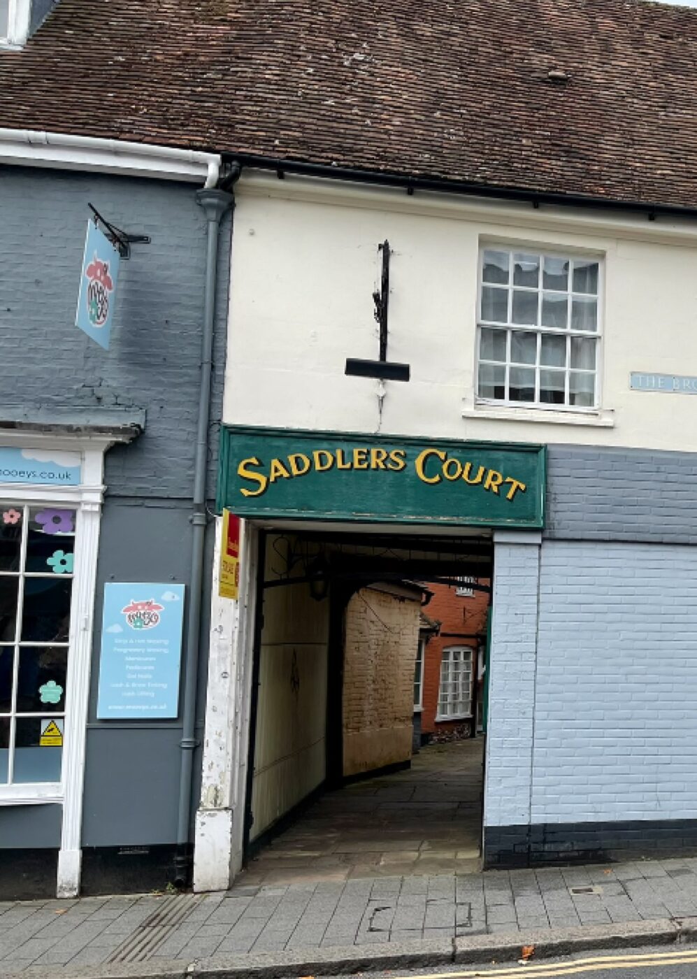
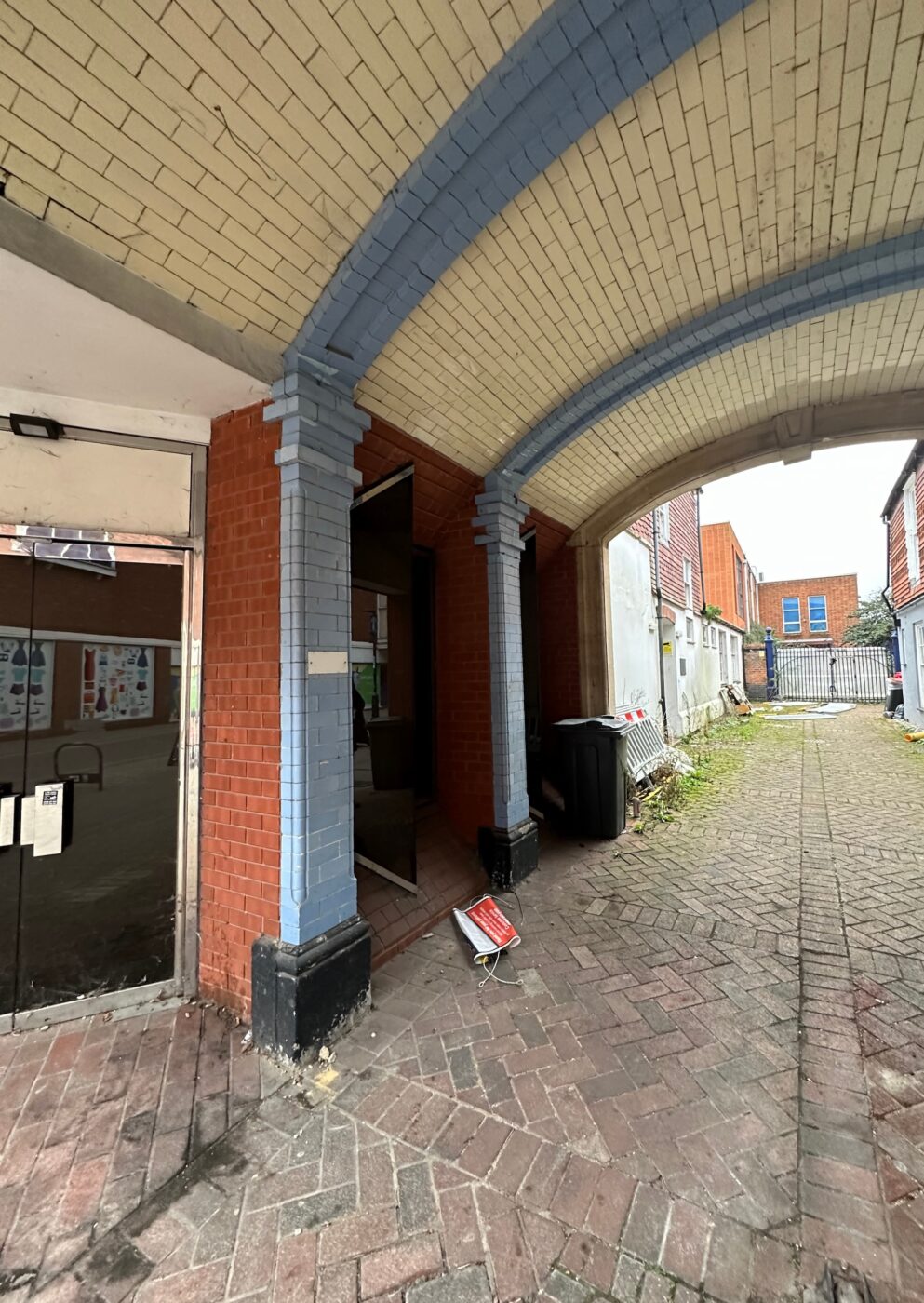
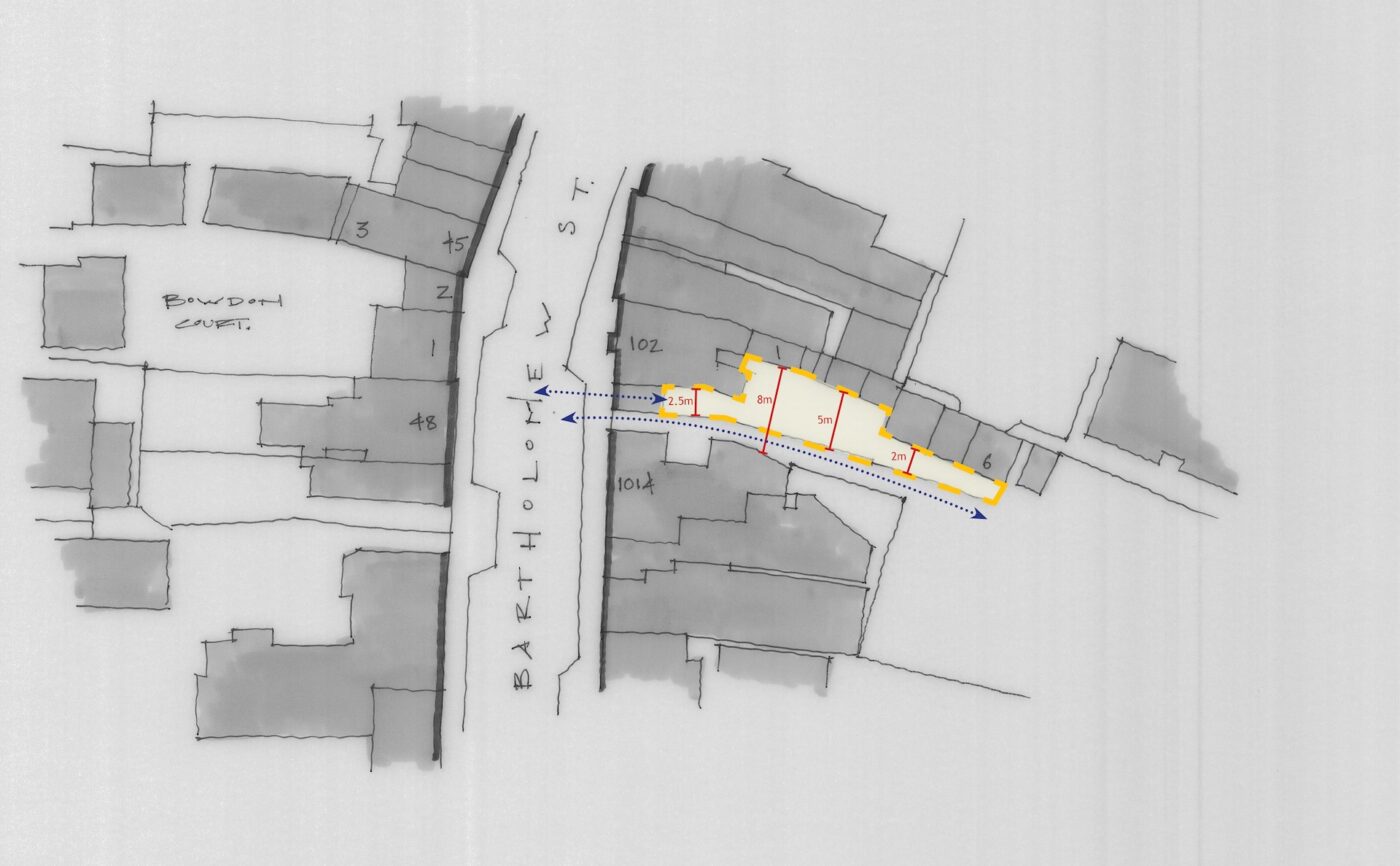
A key characteristic of the Newbury Conservation Area is the collection of Passageways, Yards, Courts and Places. All of the historic examples within the Application Site have been lost. However, there are still some existing examples in the vicinity. The above examples are, Saddler’s Court, The Arcade (formerly Church Court), Northcroft Lane and Cromwell Place.
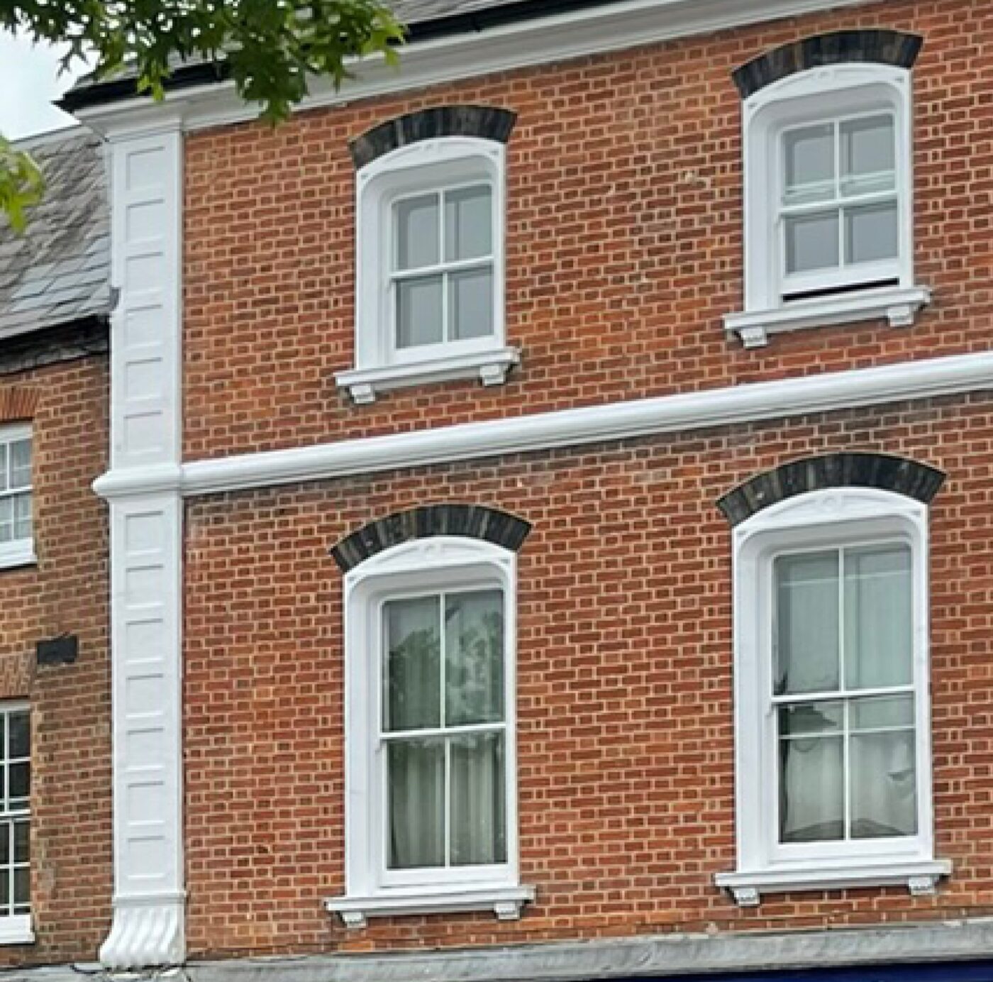
Windows
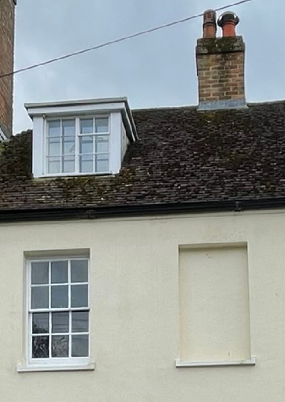
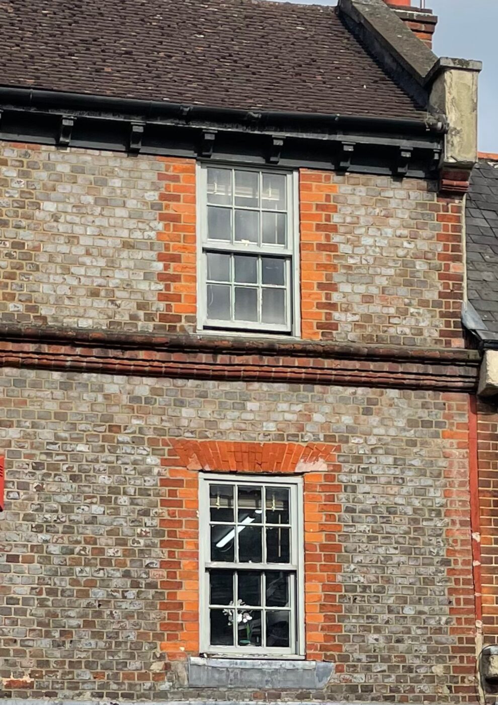
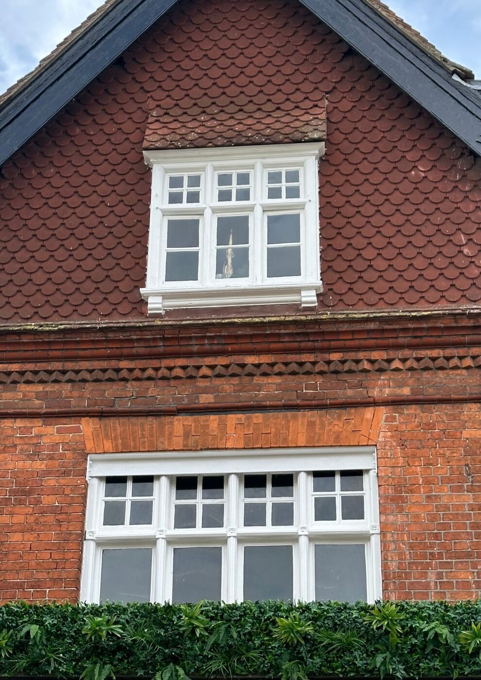
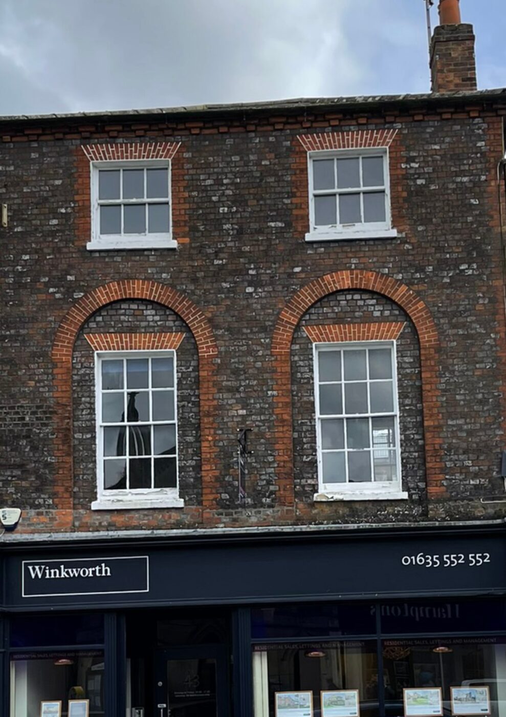
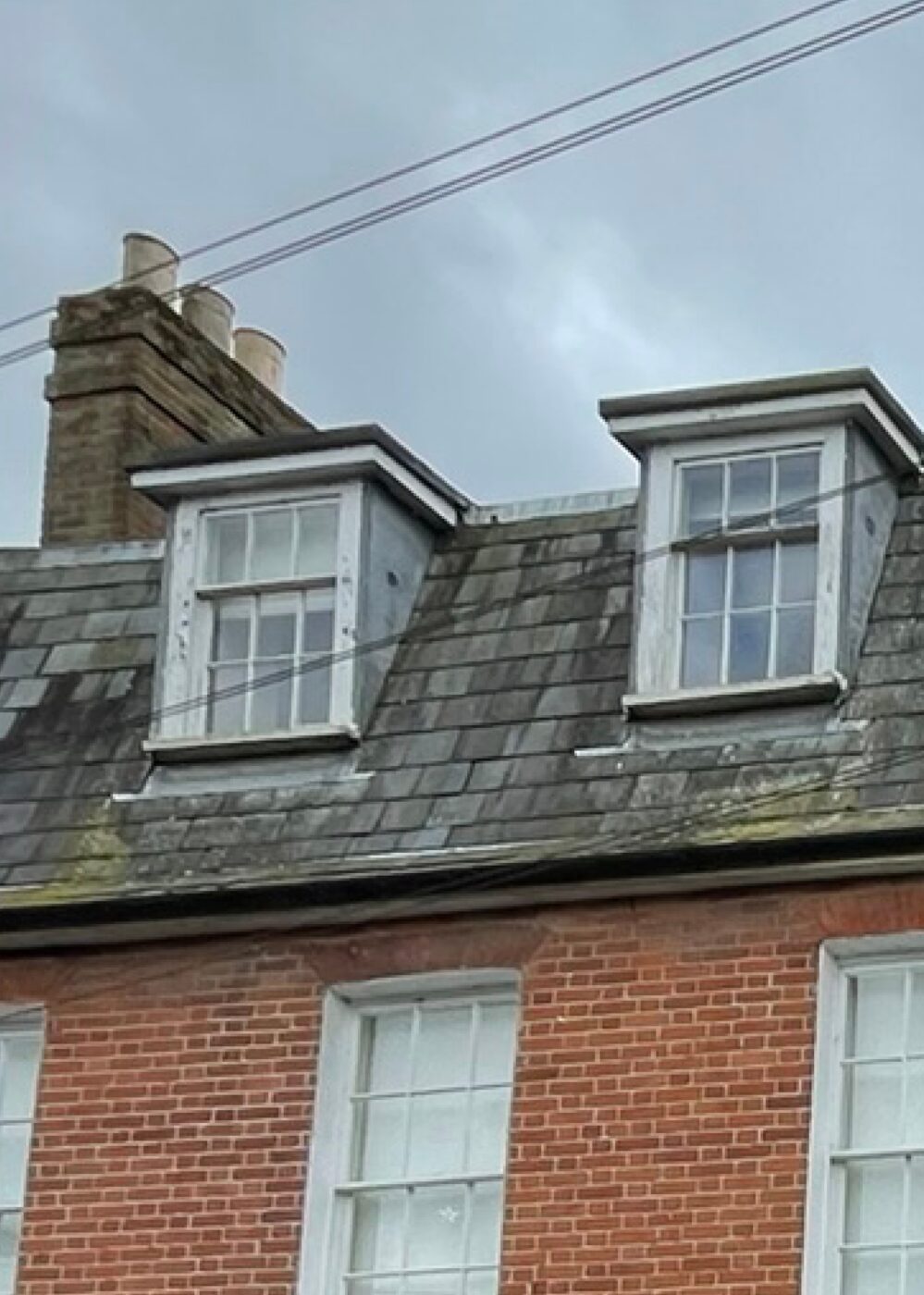
The local character is typically Georgian, generally using sliding sash windows or small casements with decorative bars. Window openings on grander buildings are often ornamented with brick quoins, soldier courses and simple cills. ‘Tax’ windows are frequently spotted too. The more utilitarian buildings have simpler and less decorative openings.
Shop frontage study
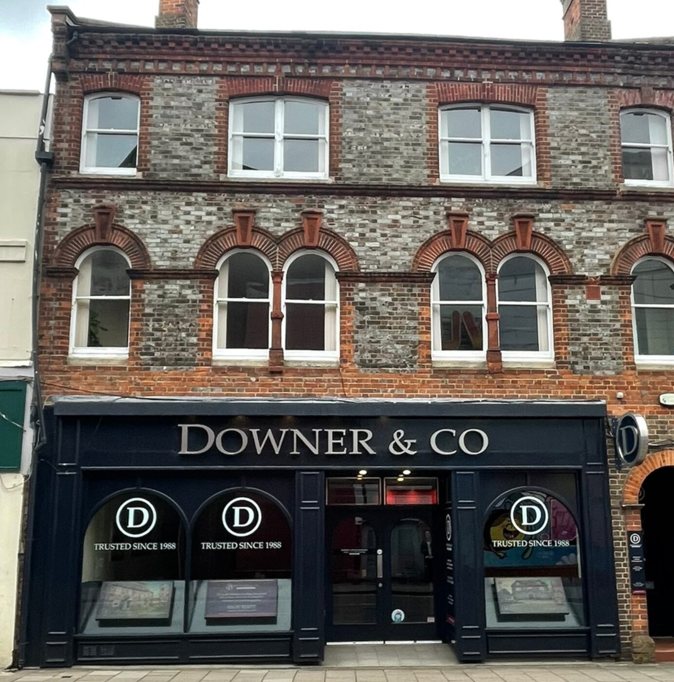
The main routes in the Conservation Area are fronted by a combination of ground floor commercial uses, such as Cafés, Public Houses, Inns, Shops and Offices. The mix of frontage design varies, some of the more successful examples are illustrated above.
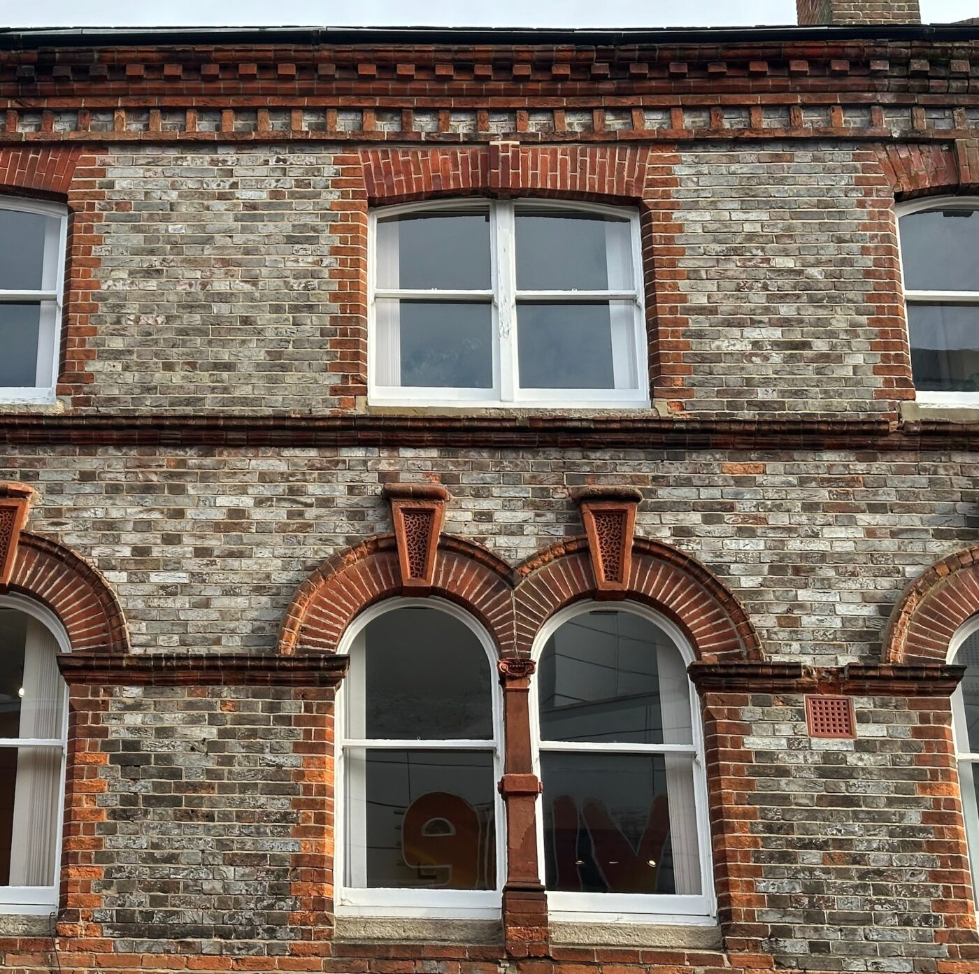
Eaves and Ridges
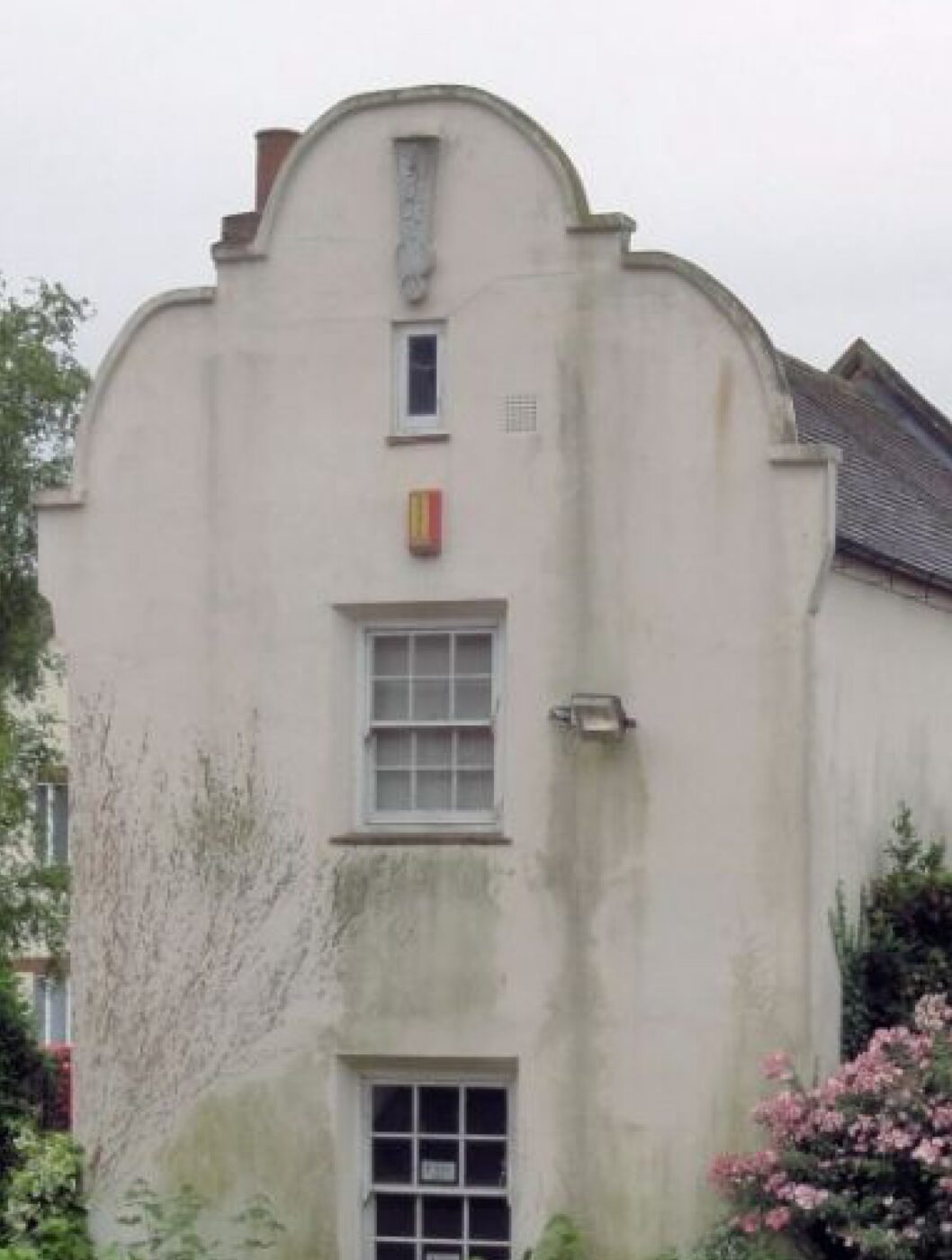
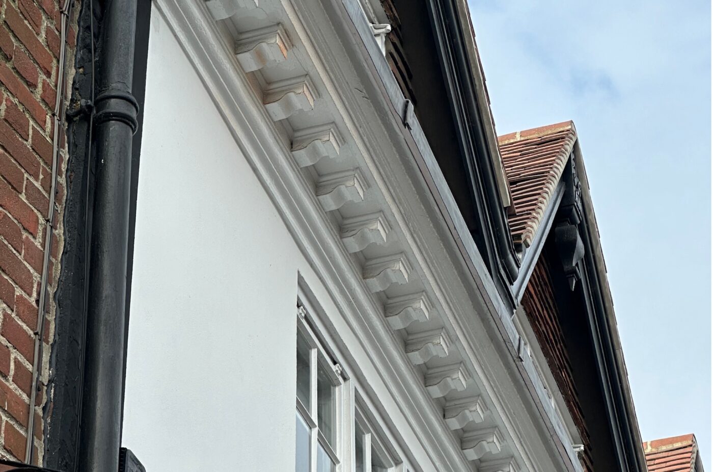
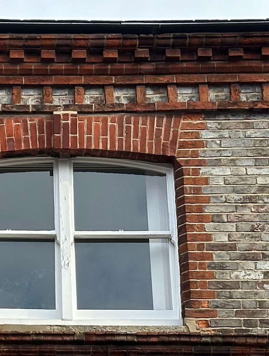
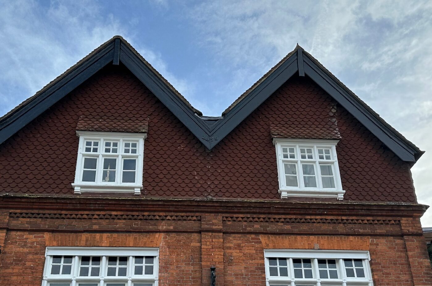
The eaves within the Newbury Conservation Area are typically brick corbels, some are more ornate than others and usually appear on the larger, grander buildings. There are numerous examples of gable frontages, finished with decorative barge boards, parapets and even a Dutch Gable. More often, dwellings present a duo-pitch to the frontage, utilising corbelled eaves or a parapet. There are also numerous examples of mansard roofs.
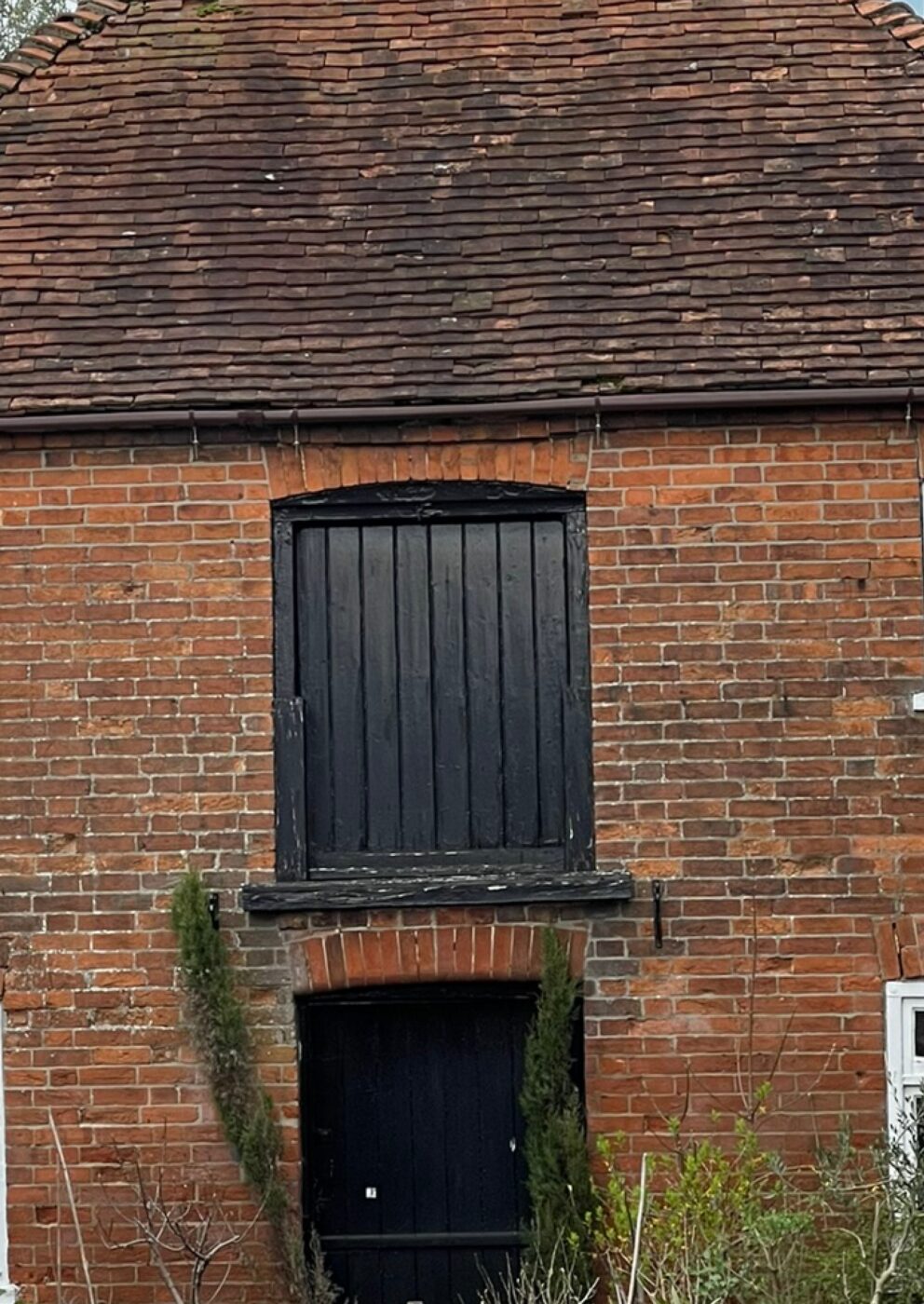
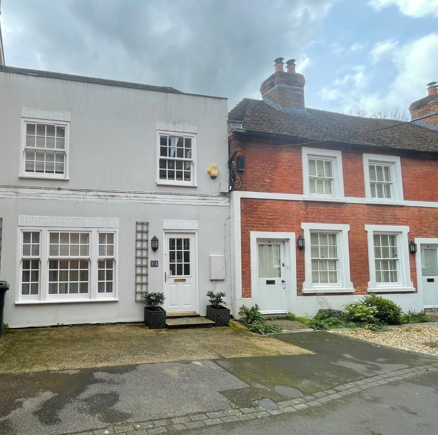
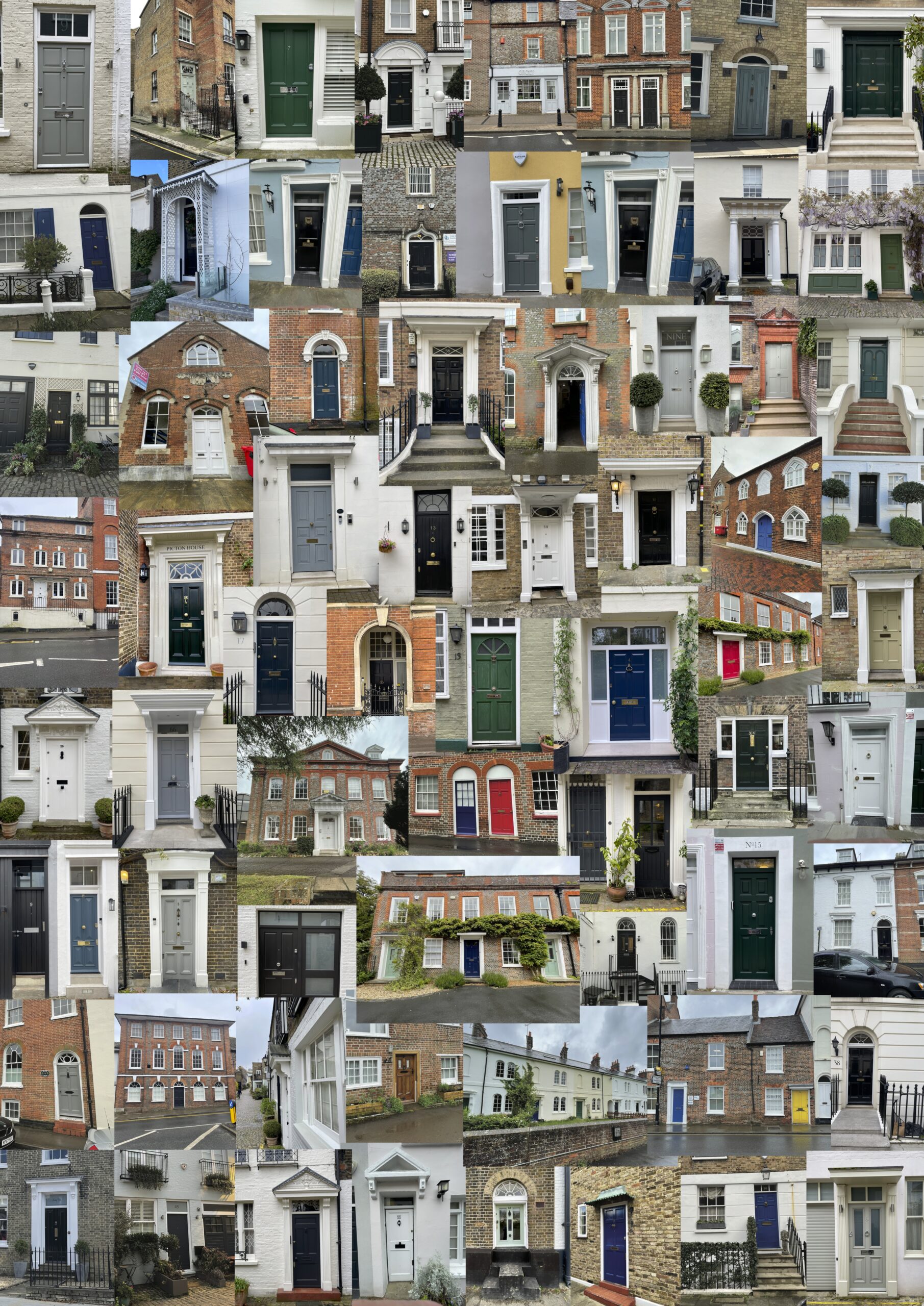
Door study
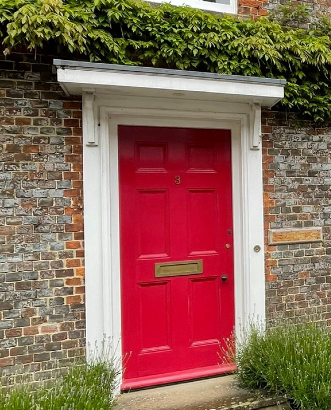
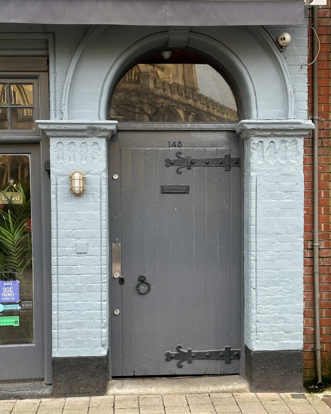
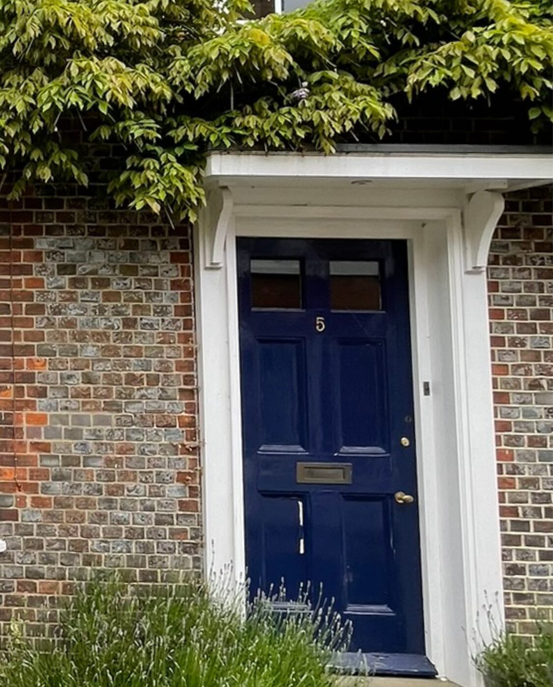
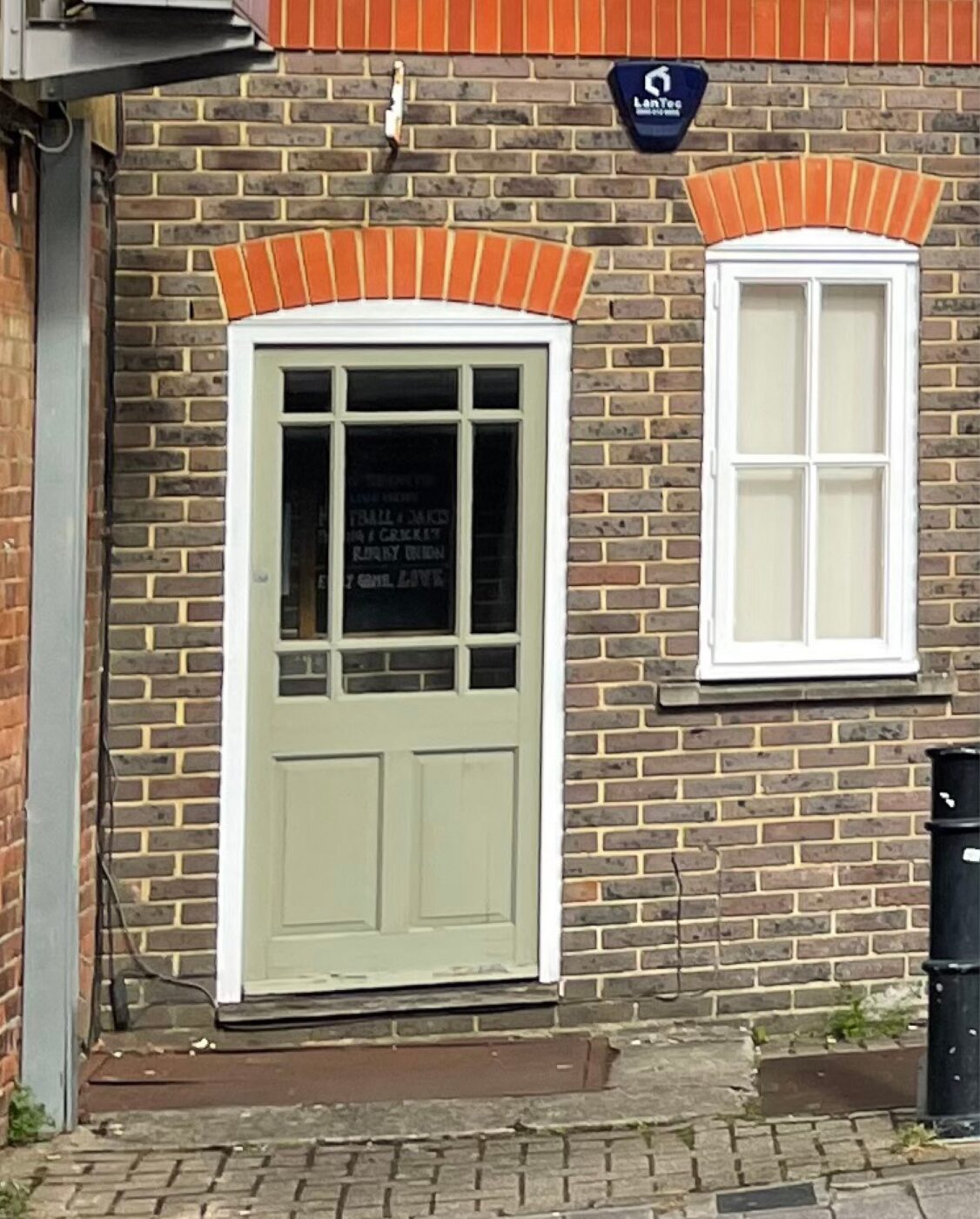
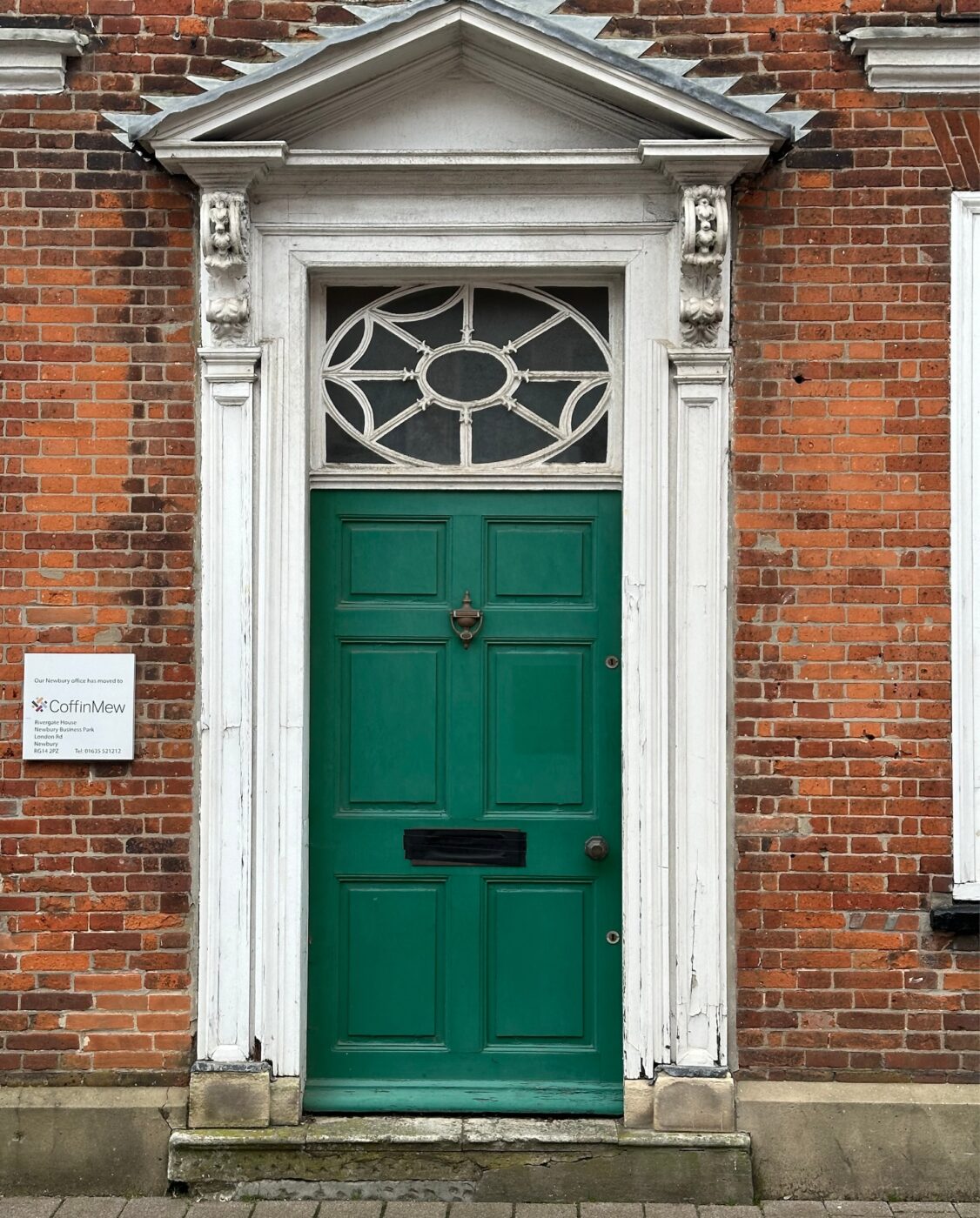
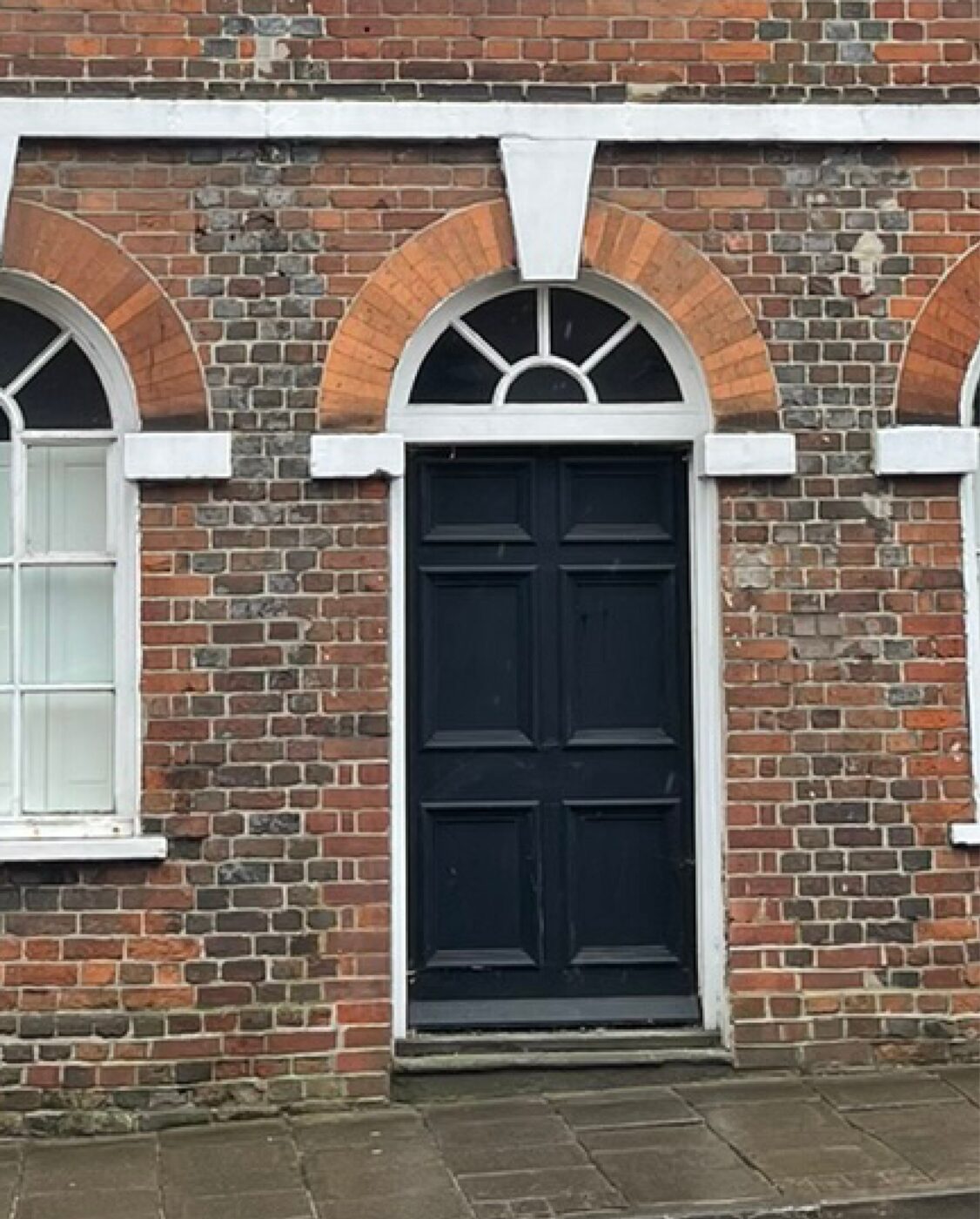
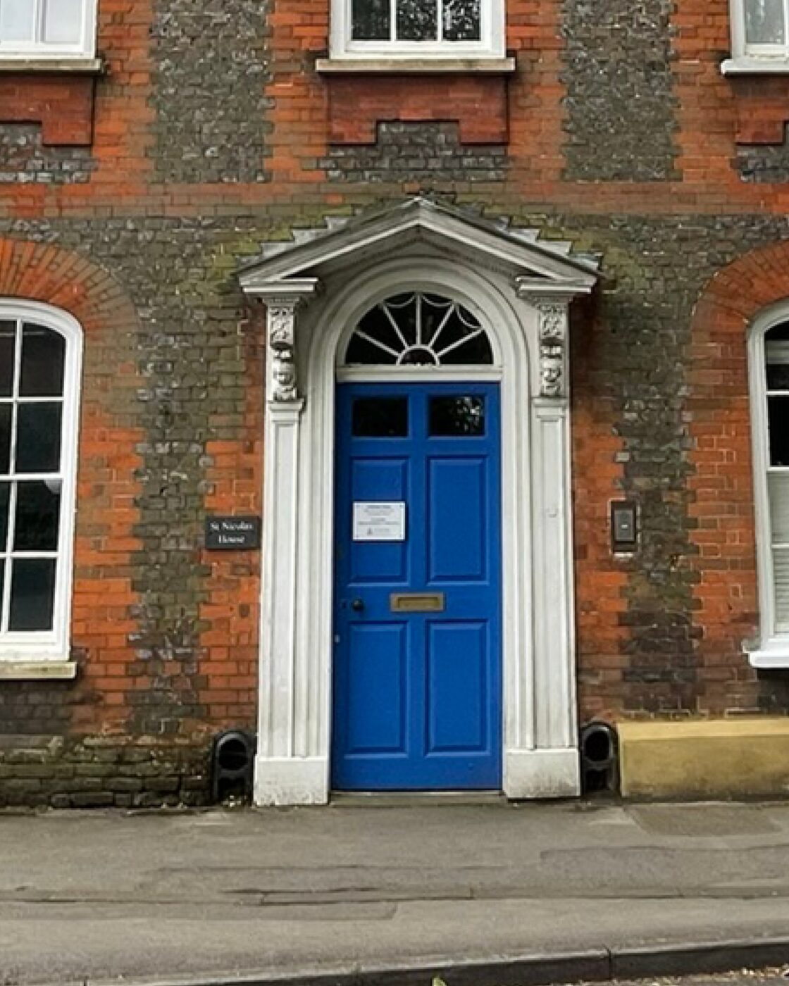
The front door is an important feature to all buildings. Differing door styles, their setting and surrounding decoration are reflective of the building’s overall grandeur or modesty.
Kimber’s Almshouses
Kimber’s Almshouses (now demolished), located off Cheap Street not far from the existing Post Office, is a wonderful historic example of the modest Georgian dwellings within a tight-knit built environment. The dwellings overlooked a well manicured passageway that led to the main street via a covered arch.
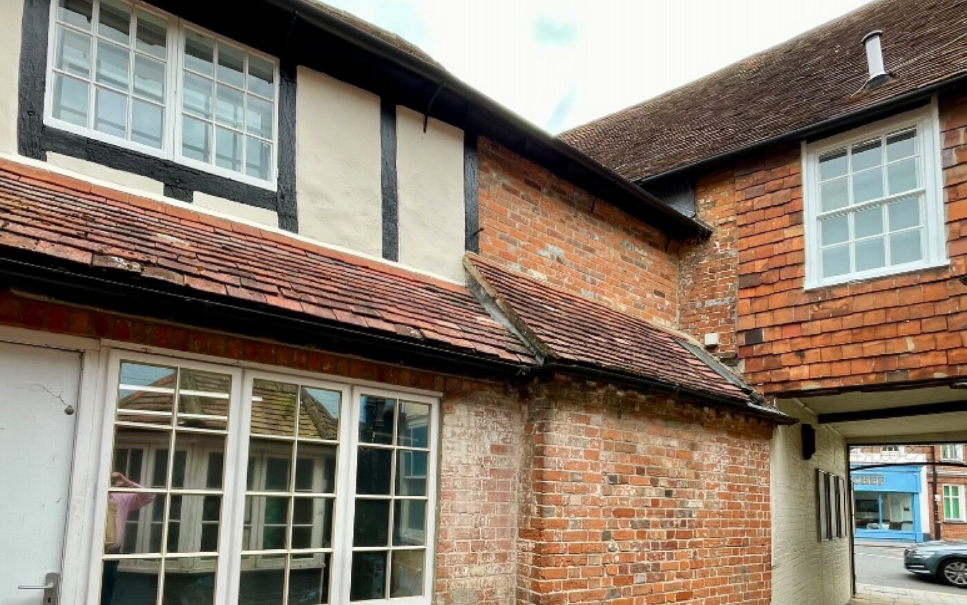
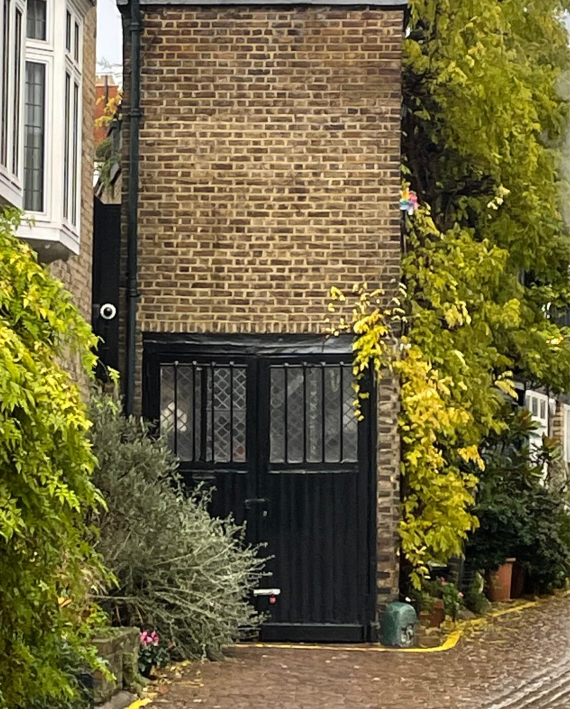
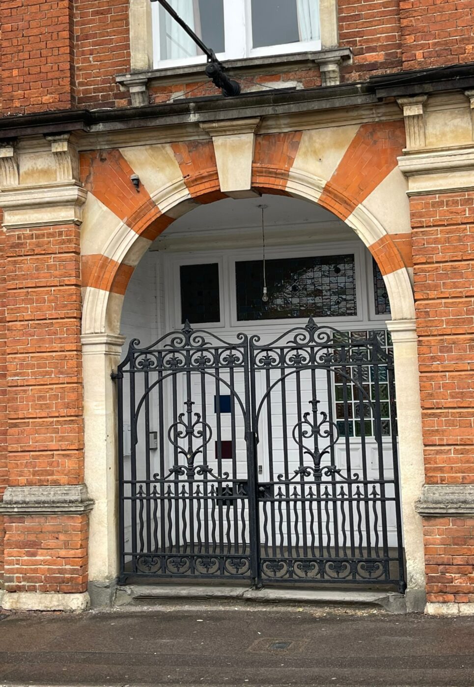
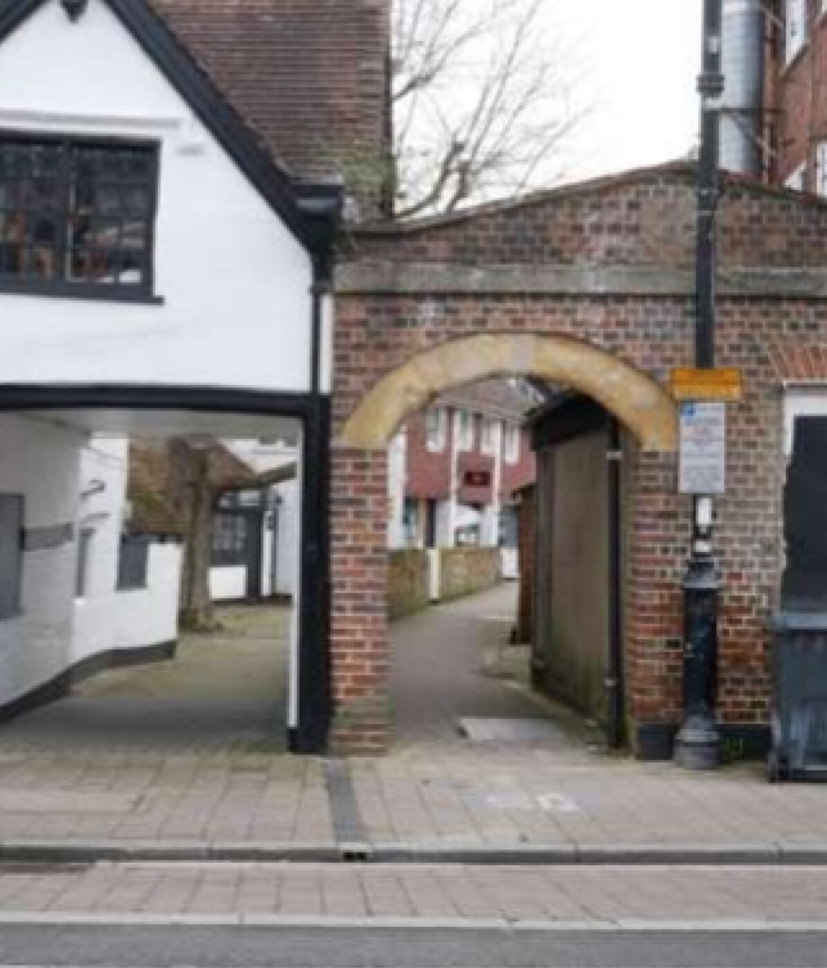
Carriage Arch, Passageway & Ginnel Study
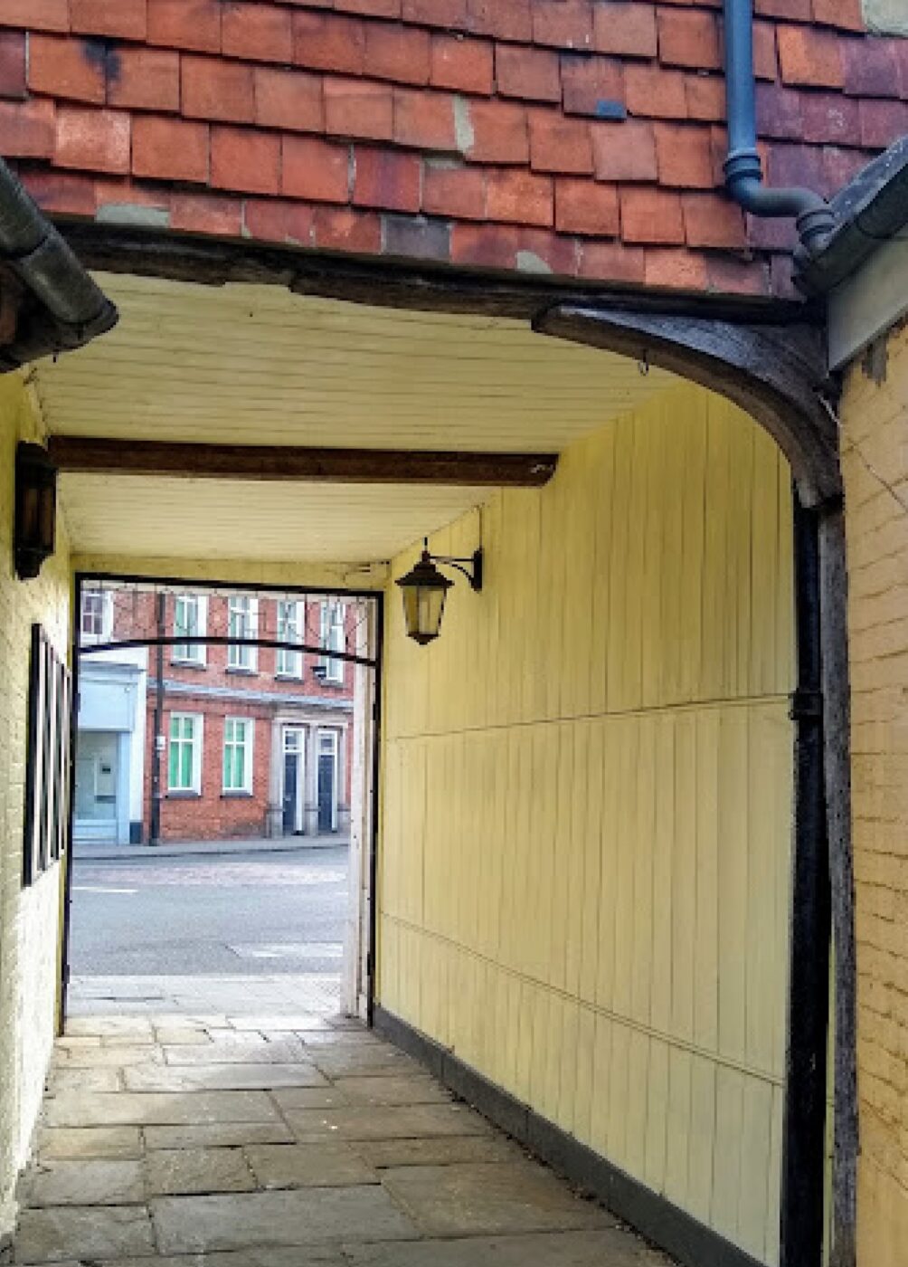
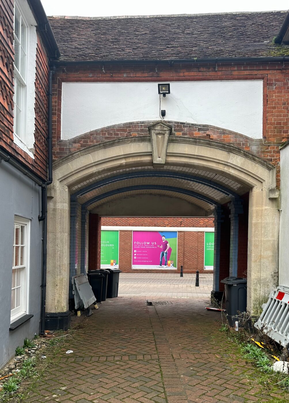
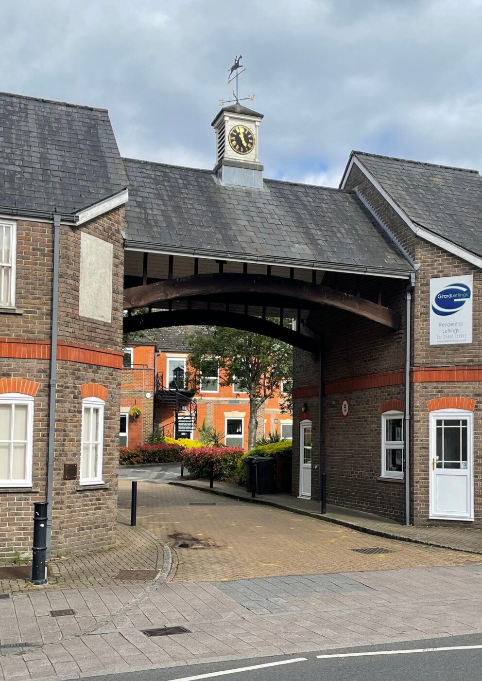
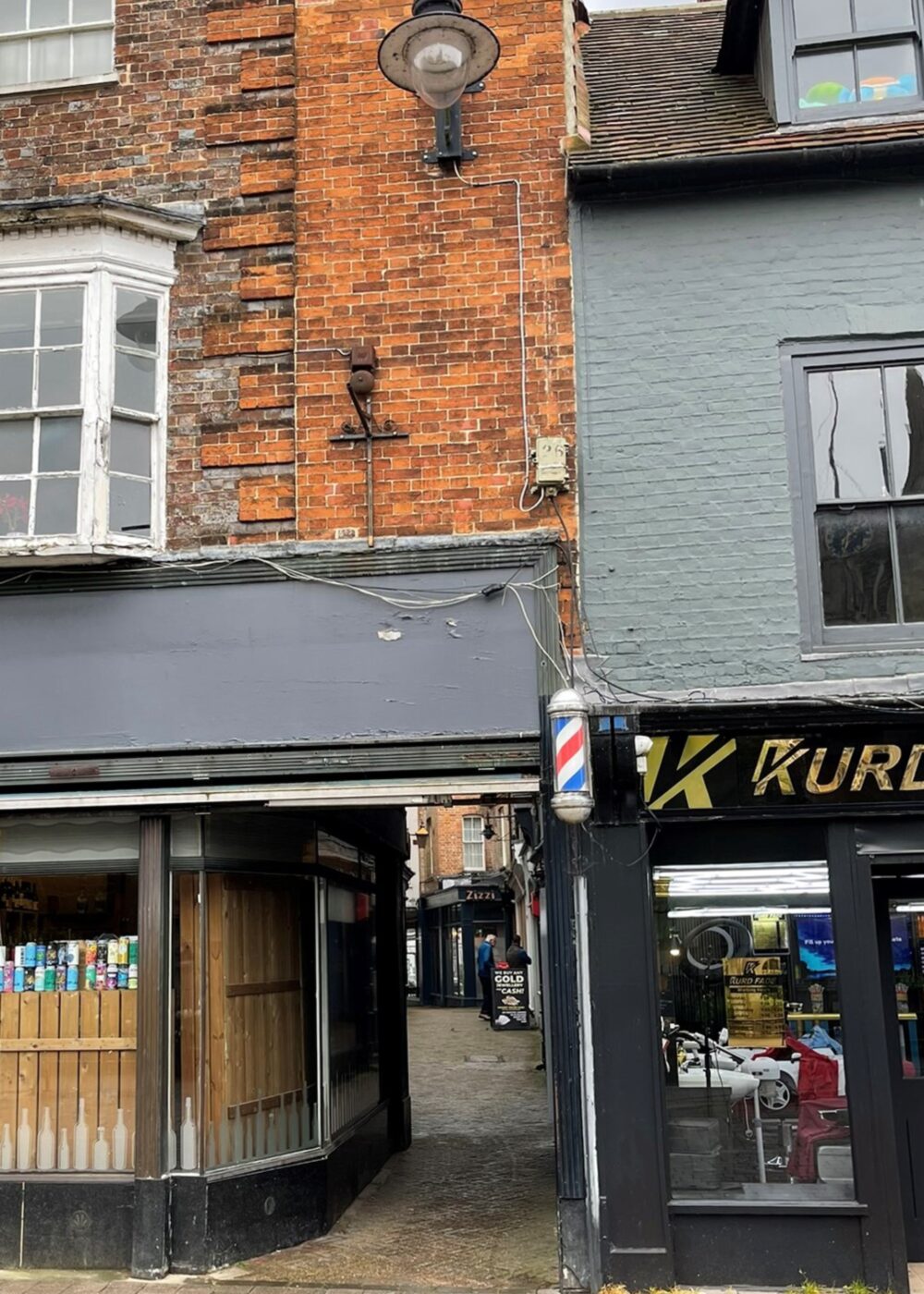
Carriage Arches, Passageways and Ginnels are numerous in quantity and vast in style and appearance. They are a key characteristic of the Conservation Area. Some retain their historic character, some have had that character eroded over the years. There are also some examples of larger gaps being bridged with Ironwork.
Material and detailing study
In addition to windows, doors, eaves, roofs, arches, passageways and ginnels, the Newbury Conservation Area is also distinct by way of the material and detailing on the building façades. A collection of those materials and details are captured above.
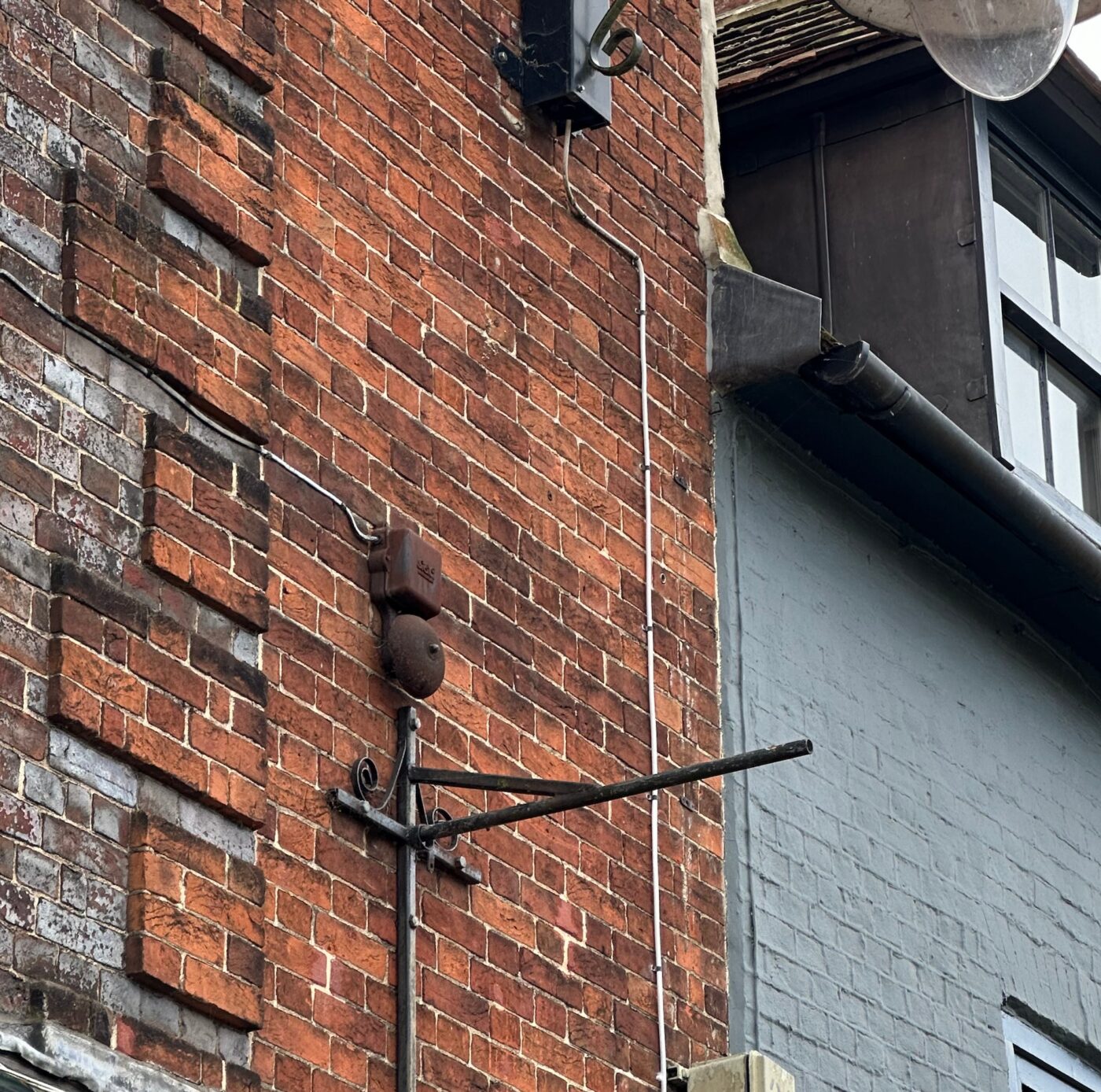
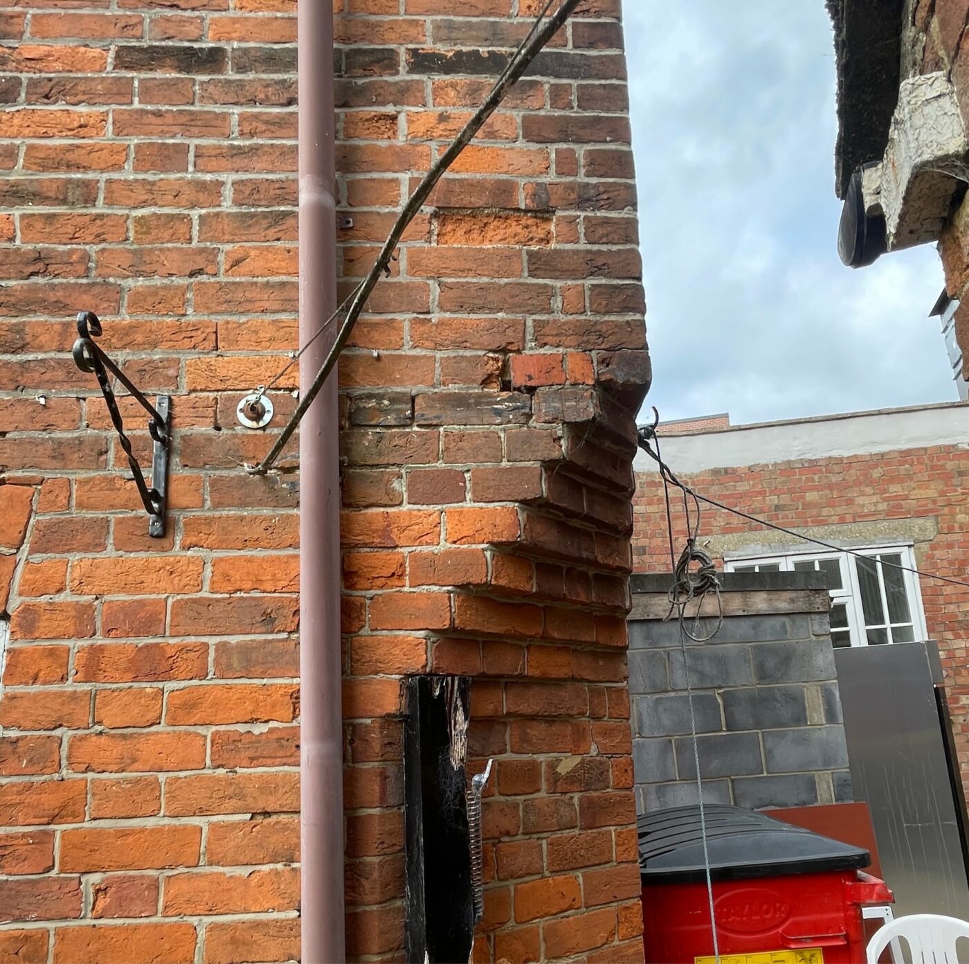
Ironwork
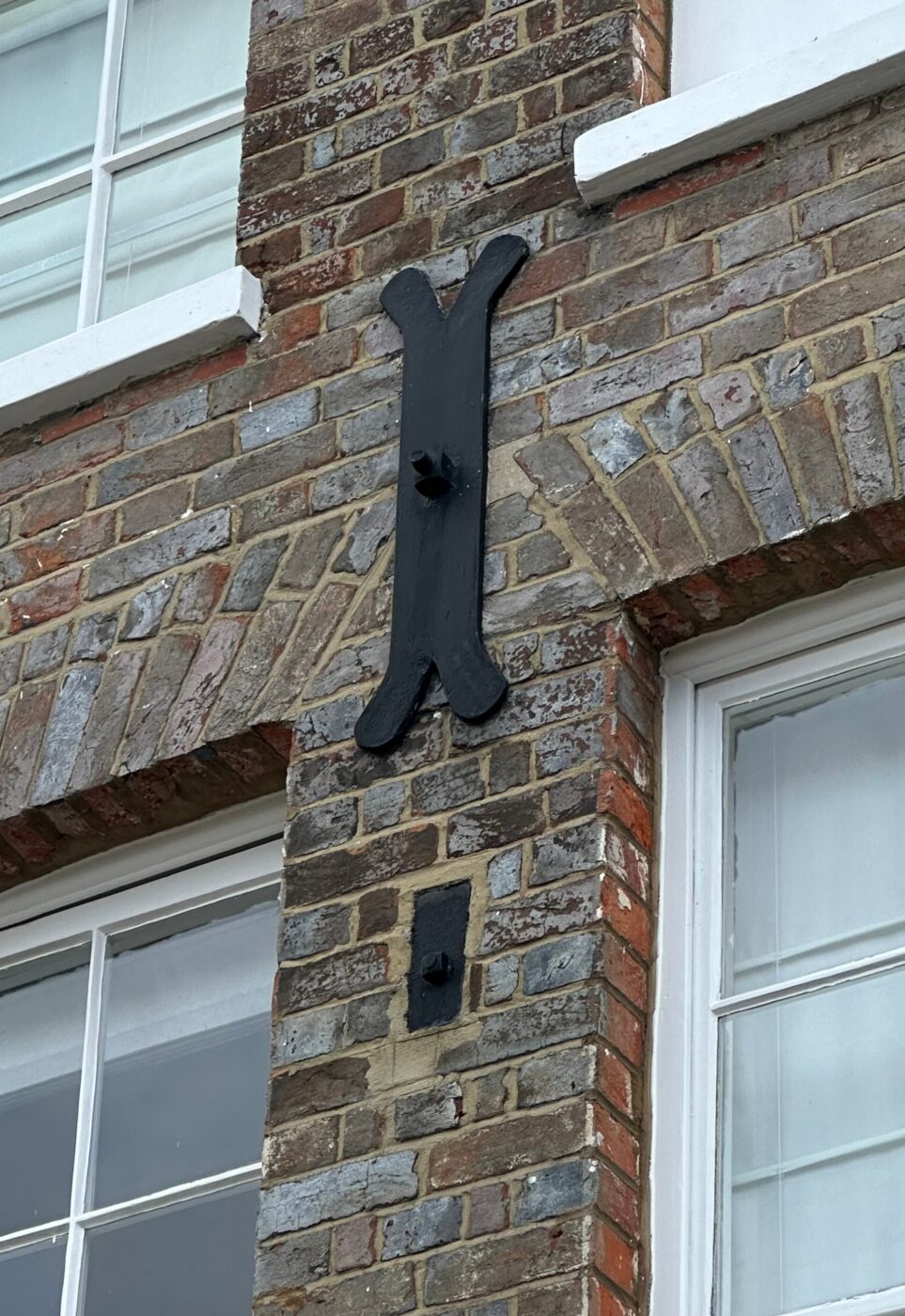
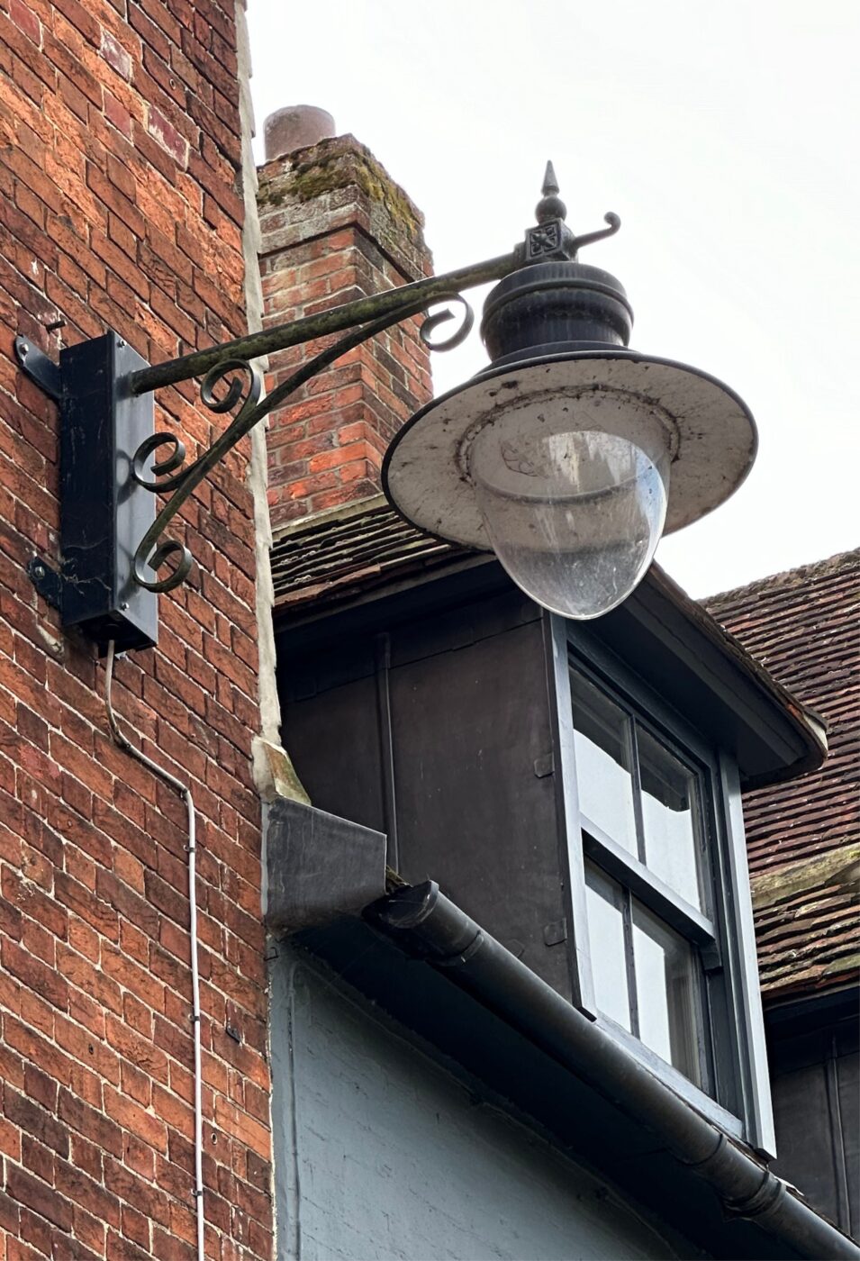
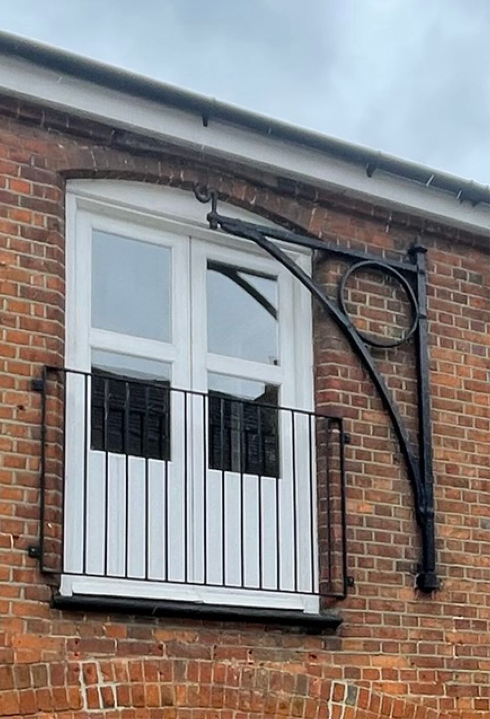
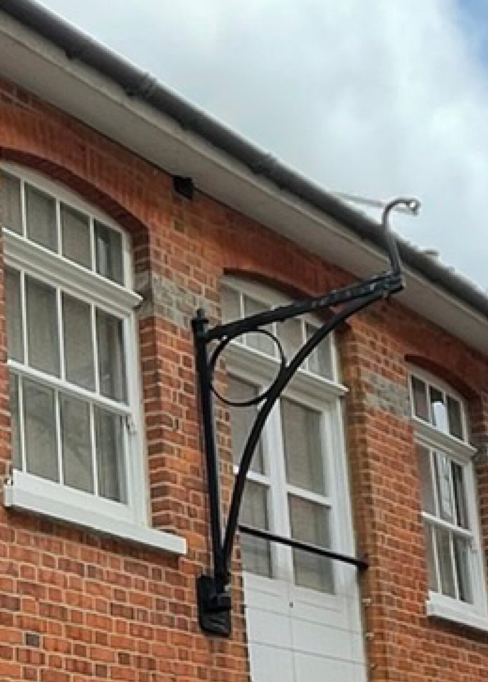

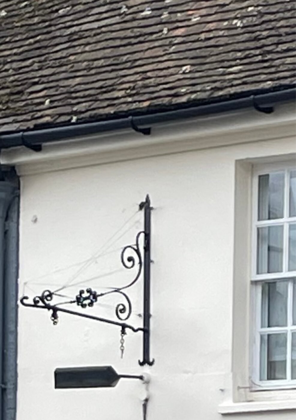
Perhaps as a consequence of the historic Ironwork in the area, or perhaps the reason why an Ironwork industry established itself in this locale (Plenty’s), fine examples of Ironwork adorning buildings are easy to find and a key characteristic of the Newbury Conservation Area.
Vine Cottages
Vine Cottages (now demolished) were located off Bartholomew Street and are good examples of the modest dwelling typology that once occupied the Application Site.
Landscaping and Architectural Detailing
Click on images to enlarge.
Bring Back the Old Town
Historic urban grain
The historic urban grain of the site can be observed and articulated using the 2D c.1880 plan on the opposing wall. The historic photographs help to explore, understand and appreciate the massing and sense of place that once characterised this part of the town.
Conservation Area character
This part of Newbury was once a thriving area of manufacturing surrounded by a collection of courts, yards and places that offered public houses, inns, cottage industries and modest residential accommodation.
Existing examples of the historic urban grain and character
In addition to ‘The Arcade’, the immediate site once contained numerous tight-knit environments, called:
- Alma Court
- Essex Place
- Chestnut Court
- Ashton Court
- Crown Court
- Gilbert Court
- Falkland Place
- Herborough Place
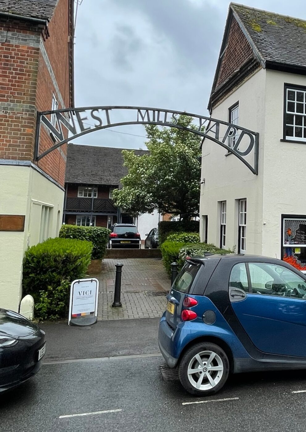
All these places have been demolished to make way for the construction of the Kennet Centre. However, other examples of the tight-knit environments still exist in Newbury which underpin the essence of ‘Old Town’. These are:
- Former Adnams Brewery
- The Arcade
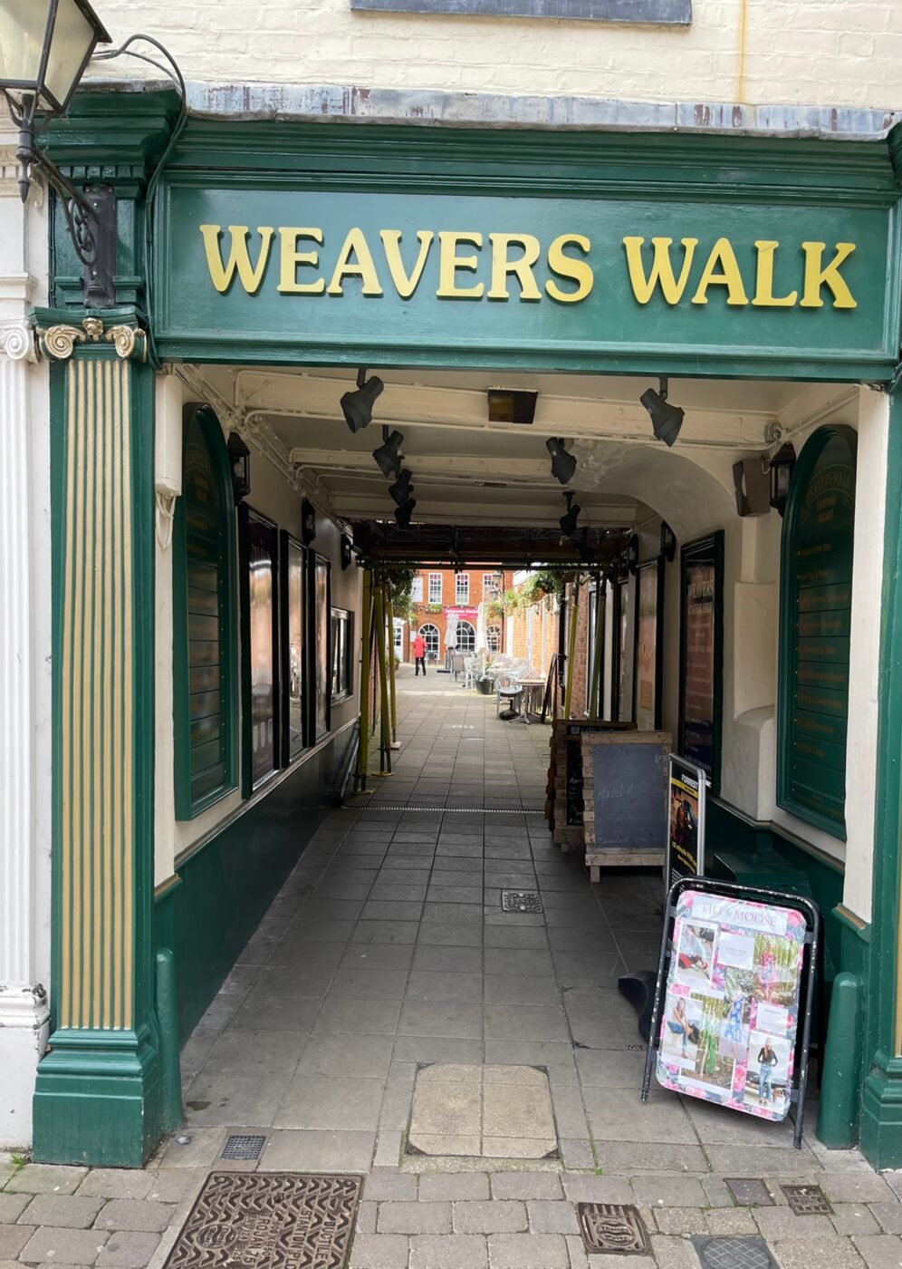
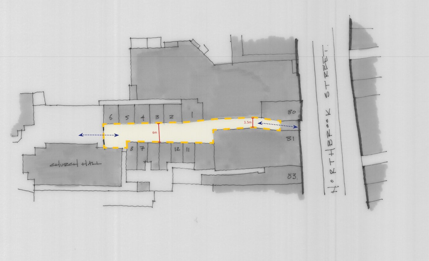
- Weavers Walk
- Northcroft Lane
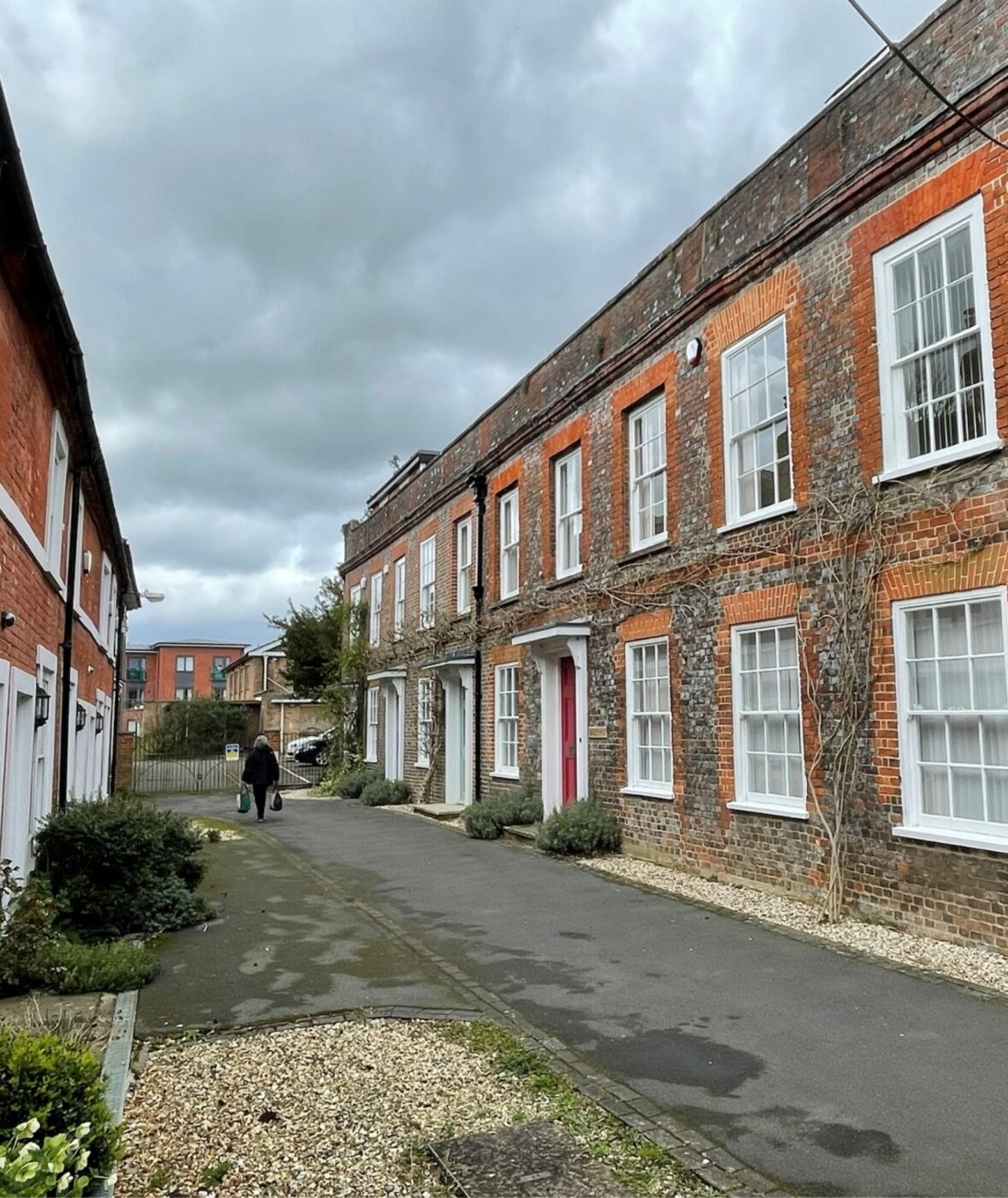
- The Courtyard
- Saddlers Court
- Cromwell Place
- Eight Bells
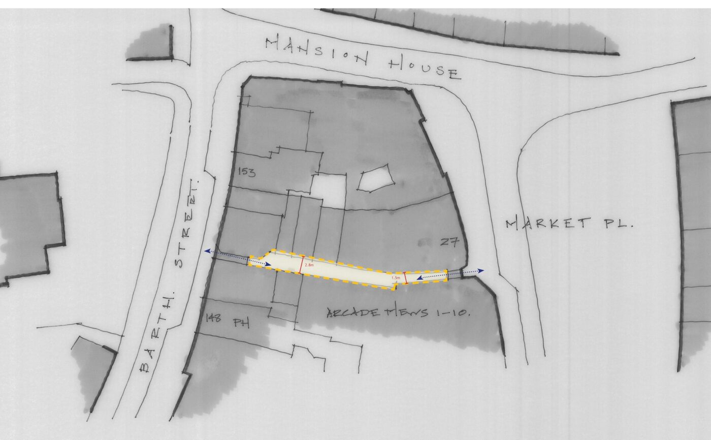
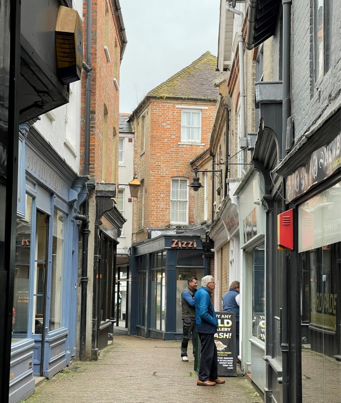
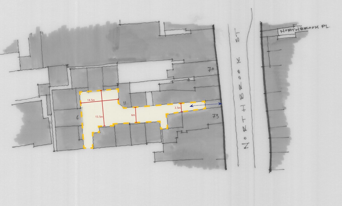
The Arcade
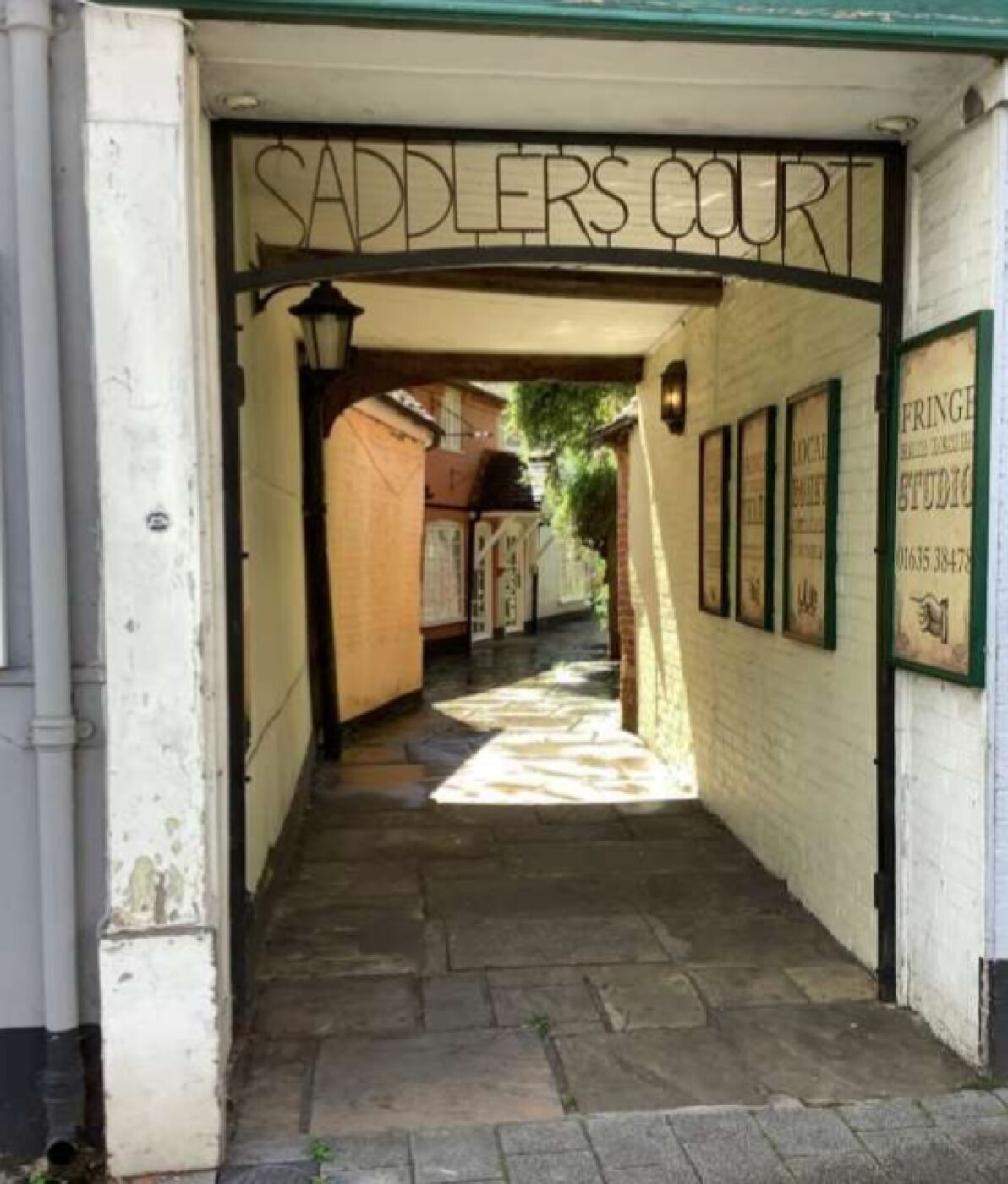
Saddlers Court
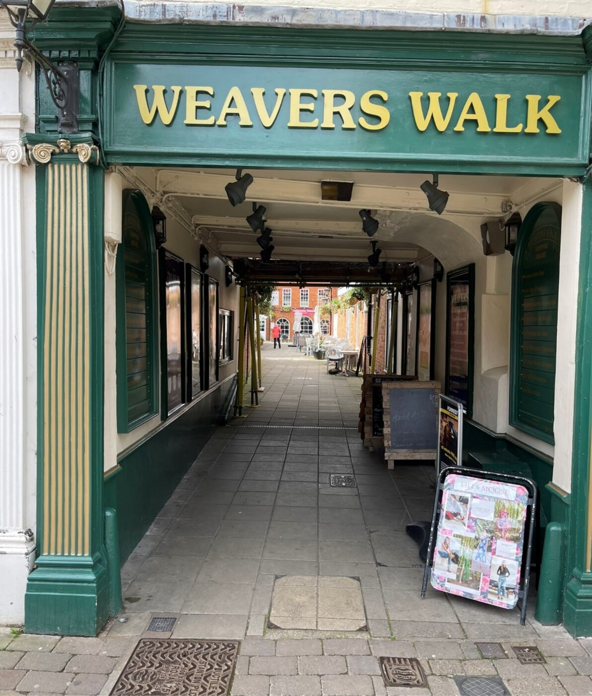
Weavers Walk
Cromwell Place
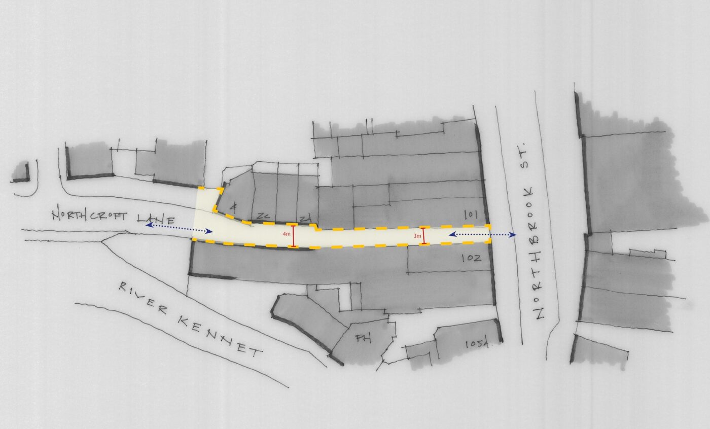
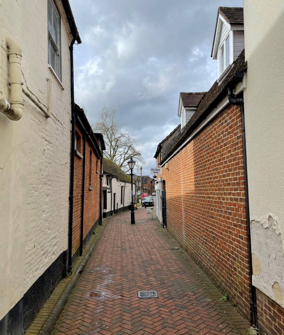
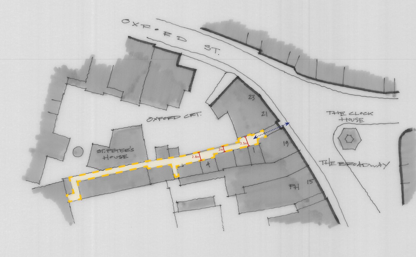
Northcroft Lane
Eight Bells
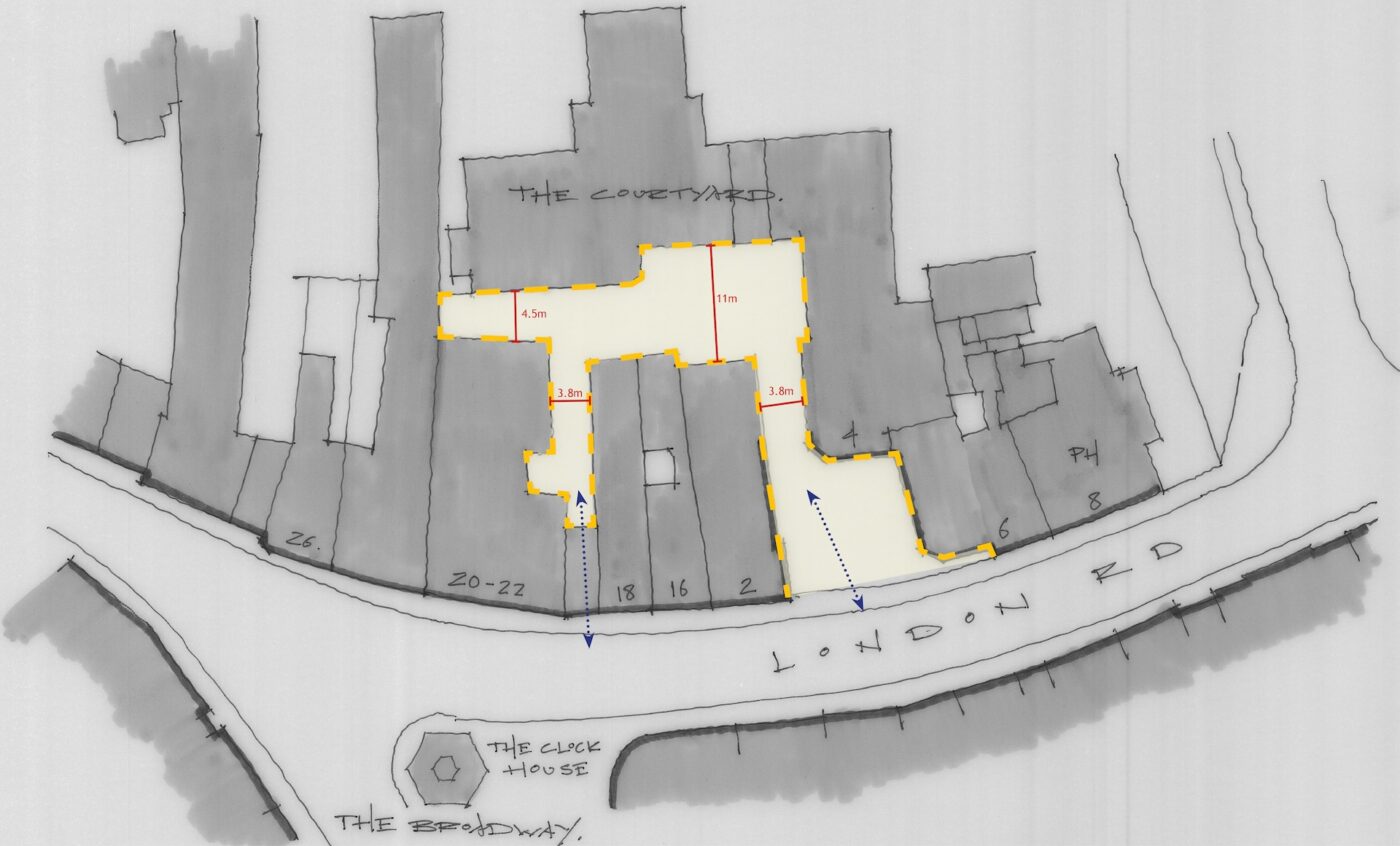
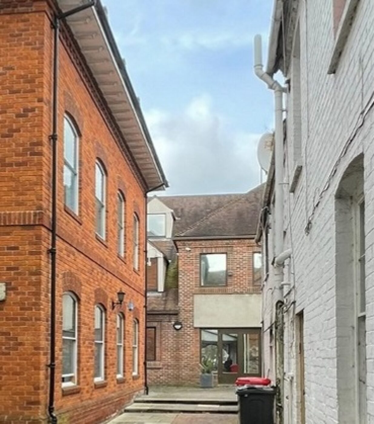
The Courtyard
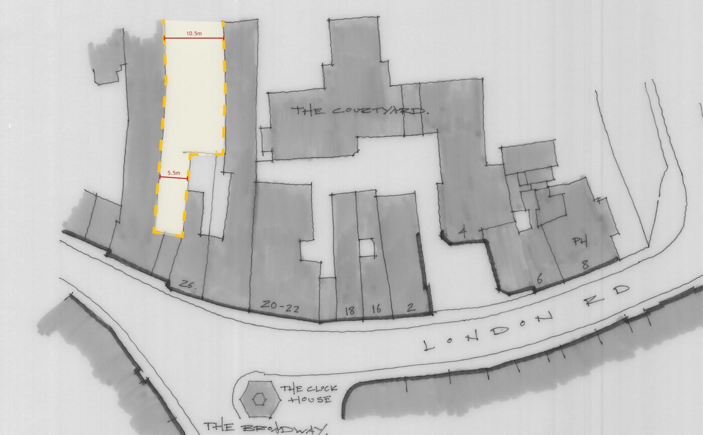
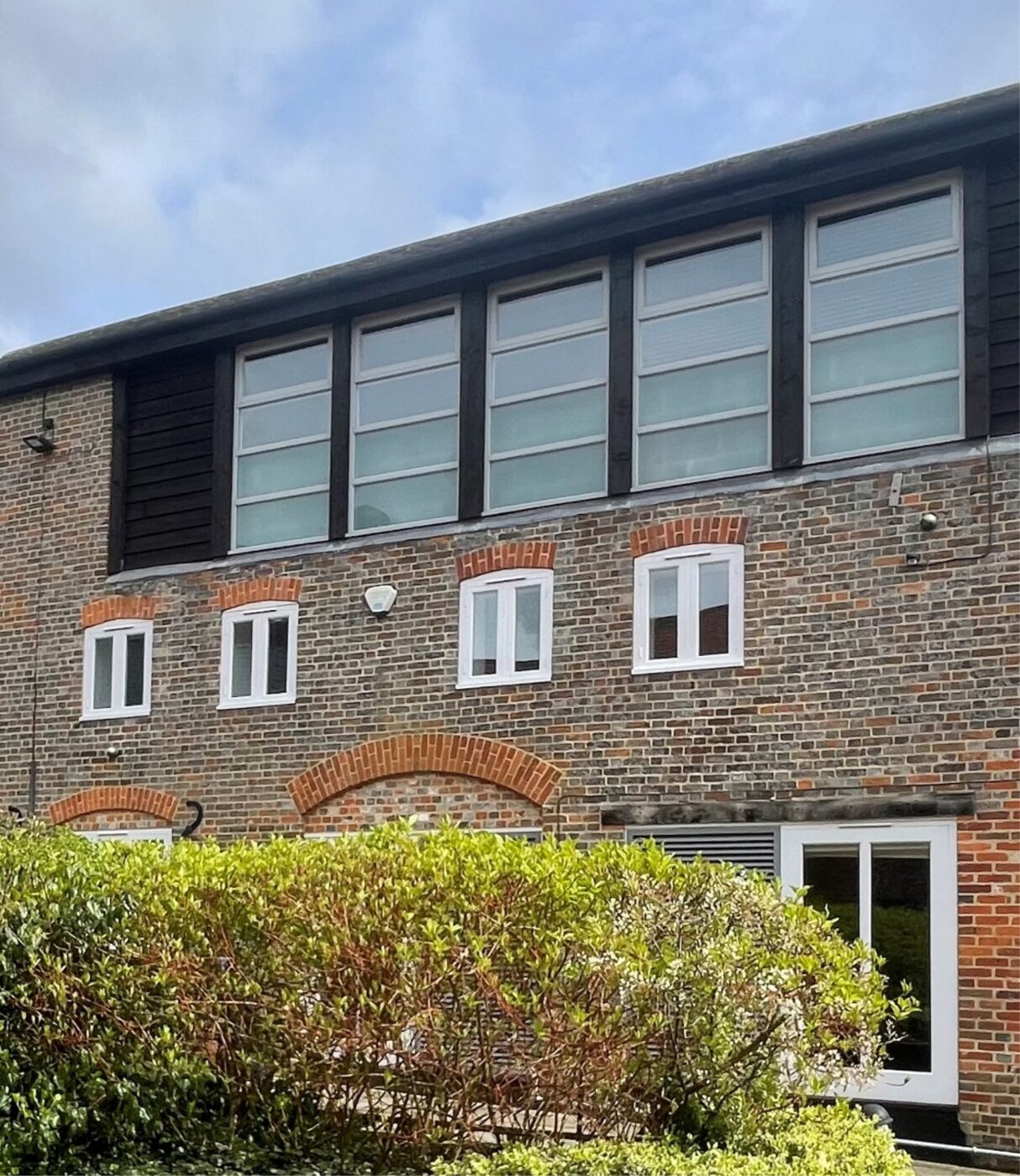
The former Adnams Brewery
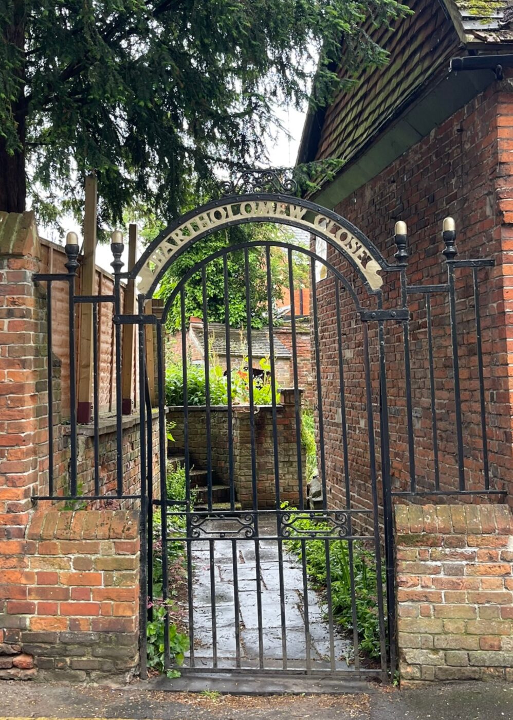
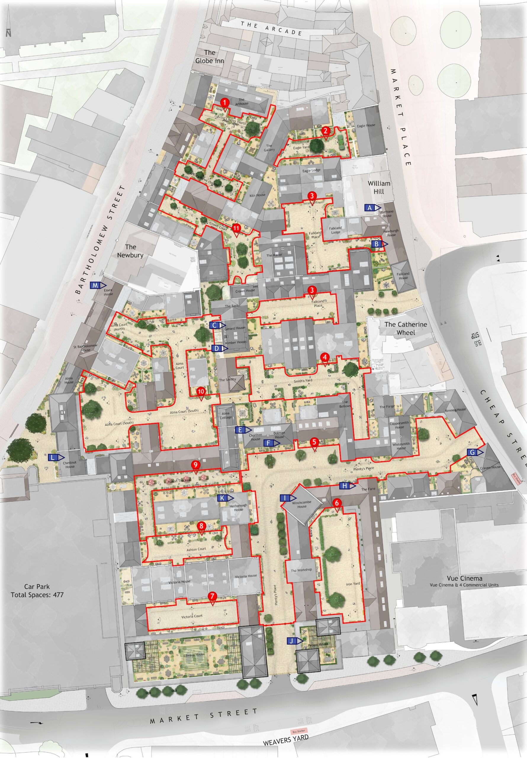
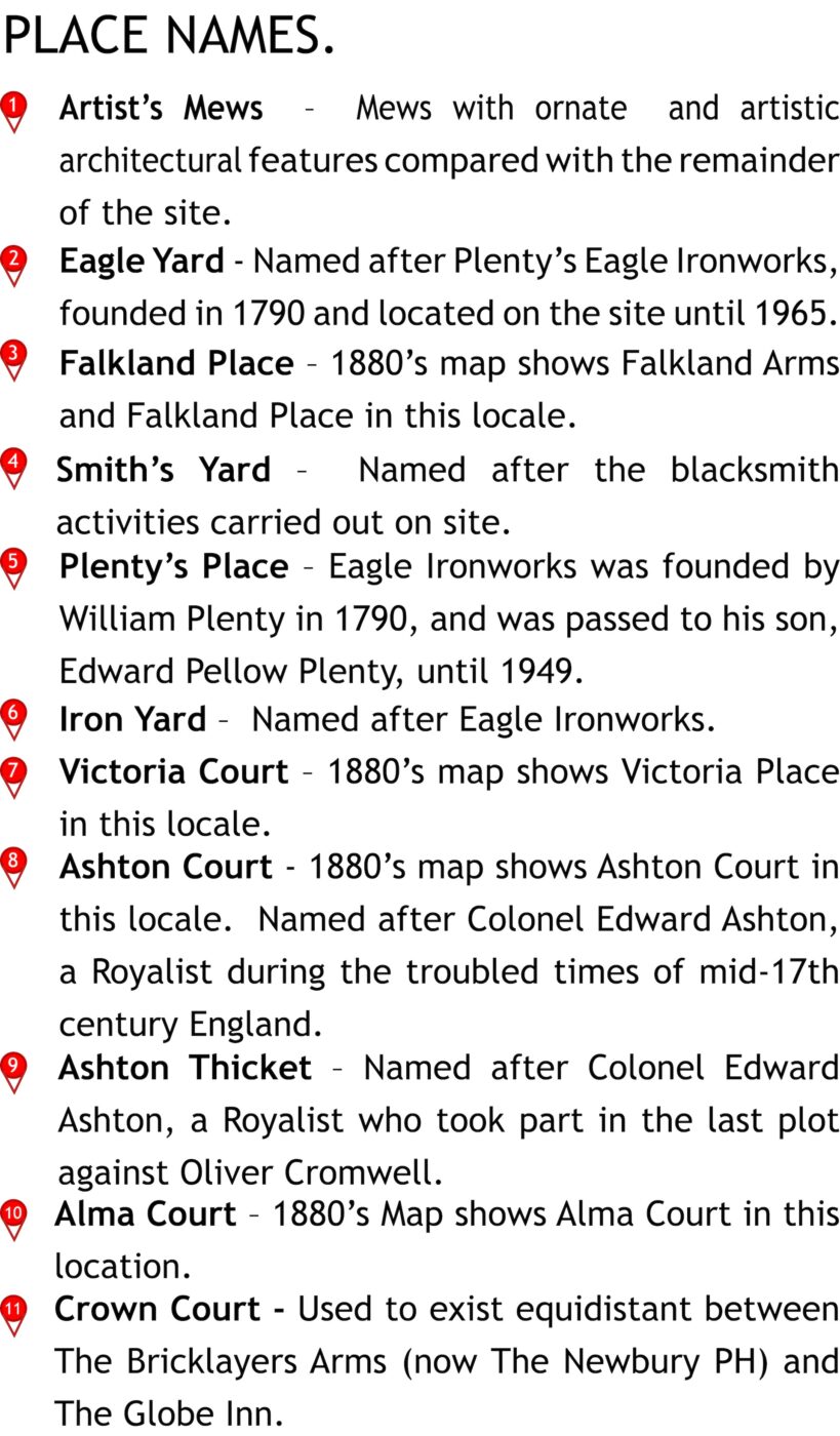
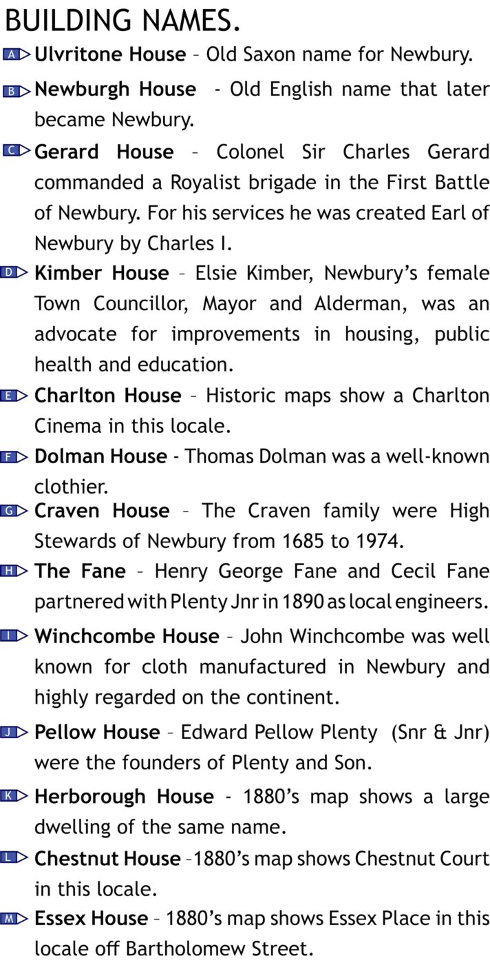
Naming Strategy
THE NAMING THEORY
In the late 19th and early 20th Centuries several Buildings, Courts, Yards, Passageways and Places within the Application Site in Newbury were named after well-known people and residents of the town. These have all since been demolished or removed, but have been used as inspiration for the naming of the proposed new spaces and buildings. Some have been taken from historical maps and many are derived from association with the Ironworks that occupied the site for 175 years.
Historic Inspiration